The Highway
Interstate 5 (I-5) runs near the West Coast, from Blaine, Washington, to San Ysidro, California, a distance of 1,381 miles. Along the way, I-5 crosses dozens of interchanges. For the long-distance traveler, many of those off-ramps are little more than an eye-blink, but for necessary stops just off the highway, gas, food, rest stops. This series of posts describes the roadway that begins at one of those intersections, Washington State Route 530 (SR 530).
State Route 530 reaches from the Interstate, through Arlington four miles east, to Darrington, 28 miles beyond Arlington, where it turns north for 19 miles to the small community of Rockport. The path of SR 530 has a long history. The current two-lane highway numbered SR 530 is the descendant of trails used by indigenous tribes, trails that followed the Stillaguamish River east to Sauk Prairie, the deep valley that is now home to Darrington. Trails led north along the Sauk River to the confluence of the Sauk with the Skagit River at what is now Rockport. The Stillaguamish tribe occupied the lower reaches of the Stillaguamish. The Stillaguamish tribal administrative center today is on a hill about four miles northwest of Arlington, overlooking the Stillaguamish River, close to the Angel of the Winds Casino that is owned by the tribe.
The Sauk-Suiattle tribal headquarters is on SR 530 between Rockport and Darrington in the Sauk Prairie area. The Sauk-Suiattle tribe once numbered as many as 6000 and ranged from the Fraser River in BC south to Stevens Pass and from east of the Cascades to the Salish Sea. Attacks by European settlers seeking farming land in the Sauk Praire and other factors have reduced the tribe to 200 members, only 45 of whom live on reservation land. The reservation consists of two areas, a section of 33.5 acres where all of the members live, and another segment of 12.1 acres in northern Snohomish channels.
Both the Stillaguamish and the Sauk-Suiattle fished for salmon in the rivers, hunted in the forests for mountain goat and deer, and traded with other tribes, using the rivers for transportation and food. The Europeans began settling the region in the mid-nineteenth century. The mountains were profligate with timber and minerals, and roads and railroads became necessary to harvest the resources.
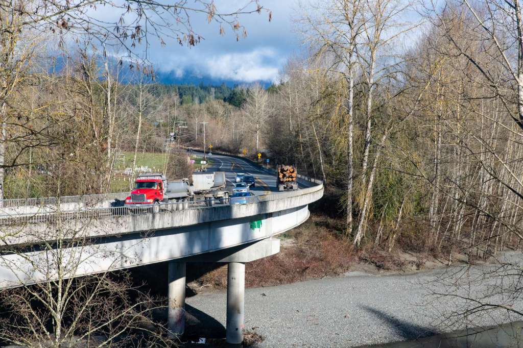
A road that followed the North Fork of the Stillaguamish River first appears on an 1899 map. That road, which more or less is the route of SR 530 along the river now, traveled from west of Arlington where river loading and unloading boats was easier, to east of the community of Oso. A 1911 map shows the road had been extended to Darrington, to transport timber and milled lumber from the mountains to the coast. The Arlington-Darrington road was renumbered as SR 530 in 1964. SR 530 was extended to Rockport in 1983.
A Northern Pacific Railway spur from Arlington to Darrington was completed in 1901 that also carried lumber and minerals from the mountains. That rail spur was named the Whitehorse Express, named after the high peak that is part of the ridge that guards the valley to the south of SR 530. The rail bed of the spur is now the Whitehorse Trail.
The history of SR 530 is significant for Snohomish County and western Washington. From indigenous tribes fishing for salmon, to lumber mills cutting the thick fir and cedar forests for construction of an adolescent Seattle and other cities to the south, to the development of Arlington as a bedroom community for Seattle and Everett, the story of SR 530 is the story of growth and change in the Pacific Northwest.

As I drive south on I-5, cross the Stillaguamish River, and turn off at the 530 ramp, I feel like I’m retracing historic steps, following roads that recede into the mists of time, paved highways that become muddy lumber roads and shadows of railroads, going backward in time. I have an old book my wife bought for me. The Little Shepherd of Kingdom Come was published in the early 20th century. It tells the story of a boy born in the remote hills of Kentucky in the 1830s, becoming a man as a Civil War rent the nation asunder. The book speaks lovingly of the misty high Appalachian hills and hollows, a place where people traveled barefoot past lonesome log cabins and villages with muddy streets, then by wagon down to the settlements and cities and big, rolling farms in the Bluegrass Country. Traveling SR 530 is making that journey in reverse, from the city of Arlington to the fir-clad, snow-capped peaks of the mountains that line the Stillaguamish valley and the Sauk Prairie.
The Stillaguamish valley begins west of Arlington with broad, flat farm fields between low hills.


The valley narrows as it proceeds east, the hills become mountains, growing tall covered with firs and cedars, snow-capped and glacier-topped near Darrington. Large farms become small family farms of one or two acres. The small farms become widely scattered, hidden among the trees. The trees march down the slopes to the valley floor. Firs and cedars, maple and alder. The spaces between are filled with blackberry brambles. The highway is anchored at its western terminus by the city of Arlington.
The Towns
Arlington
Twenty-nine miles north of Seattle’s Space Needle, a traveler on I-5 will pass through Everett and then Marysville. Ten miles north of the Marysville exit is State Route 530, the main exit for Arlington. Off the ramp, turning right, the road passes a truck stop on the right. Driving south from Bellingham or Mt Vernon, I-5 leaps across the Stillaguamish River, before reaching the SR 530 exit. If heading south on I-5, the traveler turns left at the bottom of the off ramp, and drives under the Interstate. West of I-5, the gently rolling land holds farms and woodlands as it slopes to Port Susan, an arm of Possession Sound.
It’s hard to tell that a small city is nearby. The area around the truck stop on both sides of the highway is farmland, level and green, barns and farm houses scattered here and there. Hills rise a half mile or less on both sides of the road, looking down on the fallow fields. Roughly four miles east, SR 530 makes a broad curve north towards the Stillaguamish River, then east again to enter downtown Arlington at the intersection of SR 530 with State Route 9.
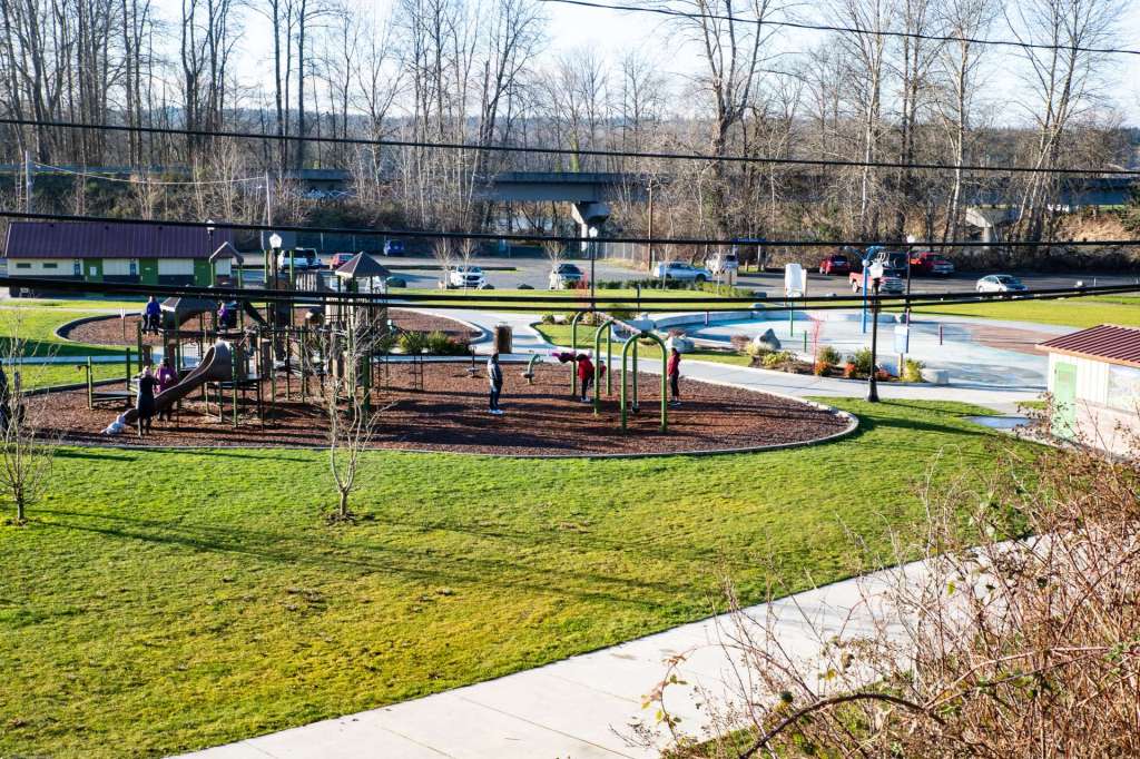
Arlington straddles I-5 and State Route 9, though old town and many of the established homes lie east of SR 9 on a succession of gradually rising terraced hills. The city is 20 miles north of Everett and 47 miles north of Seattle. Roughly 20,000 people live in Arlington. Most of the area around Arlington is small, family farms growing dairy cattle, pigs, chickens, goats, corn, and berries. Several plant nurseries face the highway. The land is fertile. Arlington is just south of the Stillaguamish River, where the confluence of the North Fork and South Fork of the Stillaguamish become the Stillaguamish, at Haller Park, on the north end of town. Haller park today is below.
Arlington was incorporated in 1903, though it was first platted in 1890. Two towns, Arlington and Haller City were platted within a month. Haller City was located on the bank of the Stillaguamish, just below the convergence of the North and South Forks. A store and hotel were located in Haller City, convenient for river travelers. Arlington was a short distance south, on higher ground. The two towns competed for several years, but Arlington’s location on higher ground offered a better site for a railroad depot.
The Seattle, Lake Shore, and Eastern Railway (SLS&E) completed tracks from the town of Snohomish, 21 miles south, to Arlington in June, 1890. The depot in Arlington was completed soon after. Gradually, shops and the hotel moved up hill to Arlington to be closer to the railroad depot. The SLS&E extended track to Sumas, on the Canadian border, where it connected with the Canadian Pacific. This railroad eventually became part of Burlington Northern, and then BNSF.

The Centennial Trail crosses the Stillaguamish River on this through truss bridge at Haller Park in Arlington. The bridge was built in 1902 for the Seattle, Lake Shore, and Eastern Railway, later the Northern Pacific Railway. The trail is on the old SLS & E rail bed and is now used by pedestrians, cyclists, and stroller pushers.
The site of Haller City is now a city park, Haller Park. The rail bridge for the SLS&E across the Stillaguamish is now a foot path, and the trail is called the Centennial Trail which extends from the historic Nakashima Barn on State Route 9, to the north, south through Arlington, past the old depot in downtown, south to the City of Snohomish on the Snohomish River.
The historic Arlington, Washington, railroad depot is now a cheerful burgundy. A spur of the old Northern Pacific tracks is behind the depot. The paved path in front of the depot is the Centennial Trail laid atop the old SLS&E rail bed. Olympic Avenue, originally Railroad Avenue, is to the right of the trail.

The north-south Centennial Trail intersects with the east-bound Whitehorse Trail a short distance north of the Stillaguamish River. This silvery arch, molded to look like two trees with interwoven branches, stands at the intersection of two trails that run on historic railway roadbeds, just north of the Stillaguamish River in Arlington. The Centennial Trail is on the left. It was the the SLS & E line, then the NP line. The Whitehorse Trail in the center curves off to the east, past Oso to Darrington, on the former road bed of the S&I, which became part of the NP.

The North and South forks of the Stillaguamish merge on the north end of Arlington to form the Stillaguamish River as it passes beneath the Centennial Trail Bridge.

Arlington begins at the Stilly and rises up a series of gentle terraces to the east. A pleasant community, convenient to Everett and Spokane, big box stores in the Smokey Point area on I-5 offer goods and services. The downtown area, including City Hall, is stretched along Olympia Avenue. Fire Station 46 is one block east on Macleod Avenue.
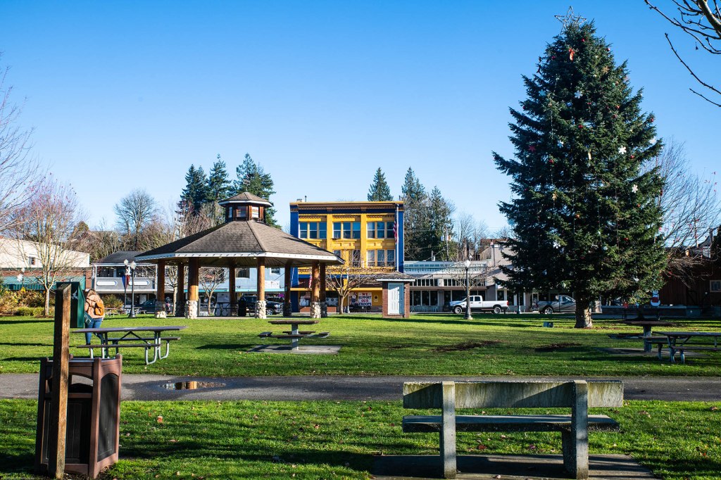
Legion Park and Centennial Trail 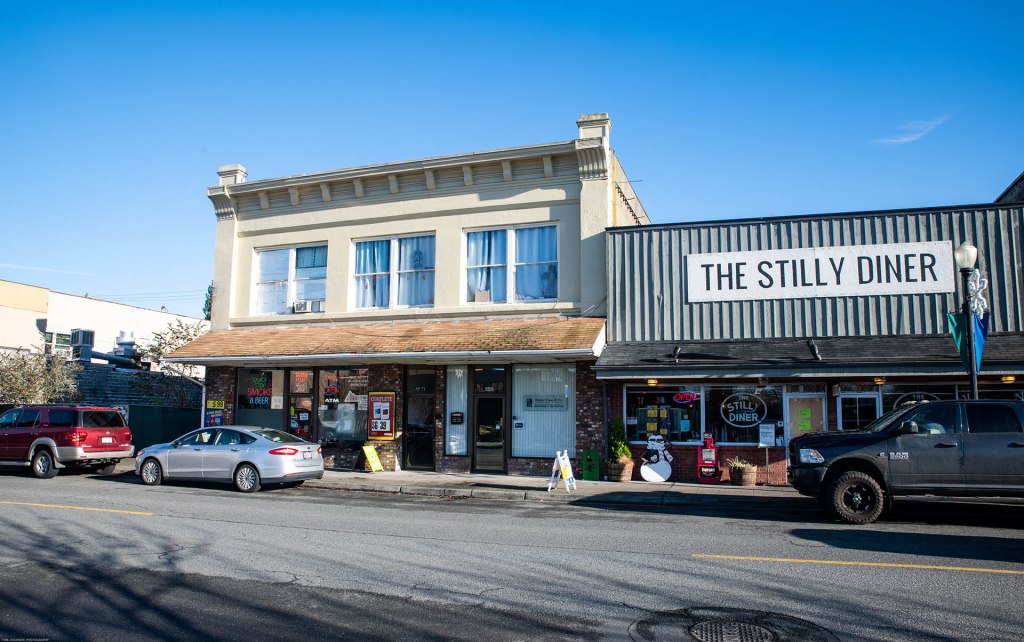
Smoke Shop and Stilly Diner 
Olympic Avenue with Snowflakes 
Arlington City Hall 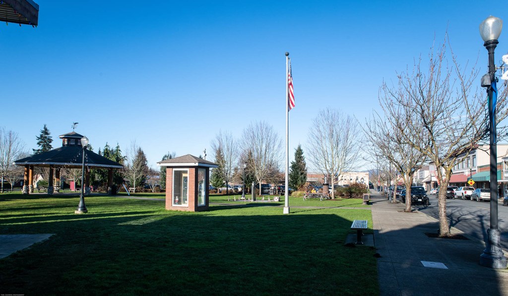
Legion Memorial Park 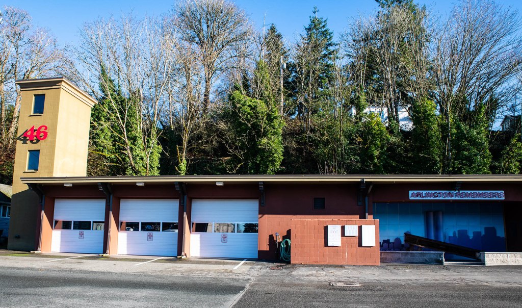
Fire House 46 In Arlington
The North Fork of the Stillaguamish separates from the South Fork just east of the Centennial Trail bridge. The North Fork twists and turns northeast and east through a narrowing valley to the small town of Darrington, 28 miles east. Small family farms spread through the valley and along the river. State Route 530 and the Whitehorse Trail follow the river to Darrington, where SR 530 turns north to follow the Sauk River to Rockport.
The story of SR 530 will continue in the next post in this series. The road travels north and east, past the Oso Slide Memorial, the subject of a separate series of blog posts, to the small town of Darrington beneath Whitehorse Mountain.
Images and text in this post and throughout this blog are copyright by Tom Cochran Vagabond Photography, unless otherwise noted.
Categories: State Route 530, Washington State Journeys

7 replies »