Beyond Deception Pass, State Route 20 continues north to a roundabout at Sharpes Corner. A spur of SR 20 continues west and north to the port city of Anacortes. The main highway turns right, toward the mainland, past the two large oil refineries on March’s Point. On the left, an explorer will see the Swinomish Casino and Lodge. The highway is divided, and the Casino can only be reached by eastbound traffic by turning right, before the Twin Bridges, at Padilla Heights Road, then left on Long John Drive and following it down and under the bridges. To continue east, the traveler must return, under the bridge and back to the highway. The casino is owned and operated by the Swinomish Indian Tribe.
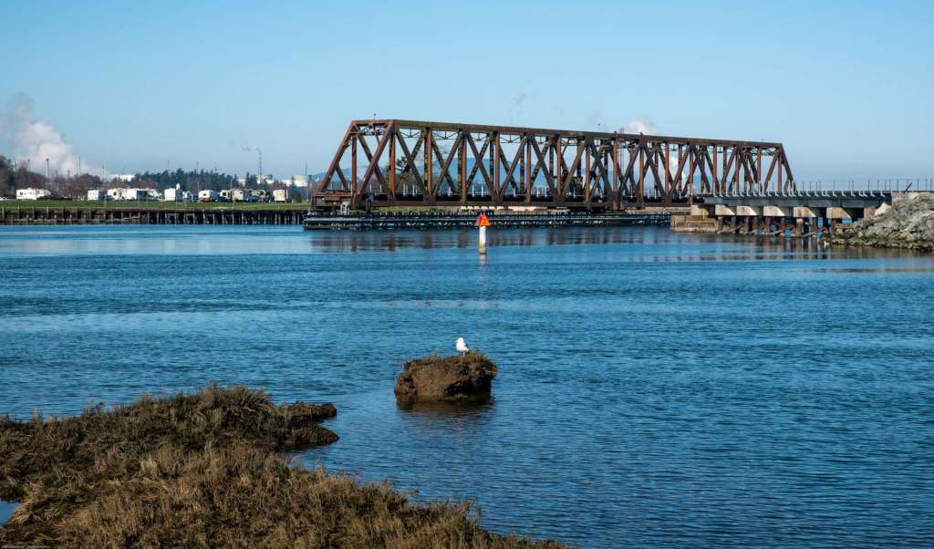
Anacortes, WA – Swinomish Channel BNSF Bridge. Driving down the hill and under the Twin Bridges, a traveler can park near the casino and walk along the Swinomish Channel that separates Fidalgo Island and the Swinomish Reservation from the Skagit County mainland. Boats should exercise caution when navigating the Swinomish Channel because of tidal flows and hidden obstructions. One of the periodic obstructions is the BNSF swing bridge that connects Fidalgo Island with the mainland.
I stood beside the BNSF swing bridge on the shore of the Swinomish Channel to shoot the open rail bridge in the middle of the channel. As I stood there, I heard a painfully loud grating, grinding, rusty gear sound. The swing bridge started to move. At the same time, I could hear a train whistle not far away. Gradually, eerily, the bridge moved into position and lined up with the tracks. The engine arrived at the far side before the bridge finished its movement, and paused for several minutes. During that time, a train employee with a hunter orange BNSF vest walked from the far side of the bridge, past my position, and up the track a short distance, checking for stuff. Probably for objects on the track. As he walked back, I asked him how often a train passed. Twice a day, he said. Most of the time the bridge sits open, as in the lower shot below, resting, and, fortunately, quiet.
The bridge is in the closed position below to carry BNSF Engine 8257 and a long train of oil cars to the refineries on March’s Point. When trains arrive on either shore, they stop and wait until the bridge closes. The bridge is operated from the small shack that hangs from the side of the bridge in the center of the image below.
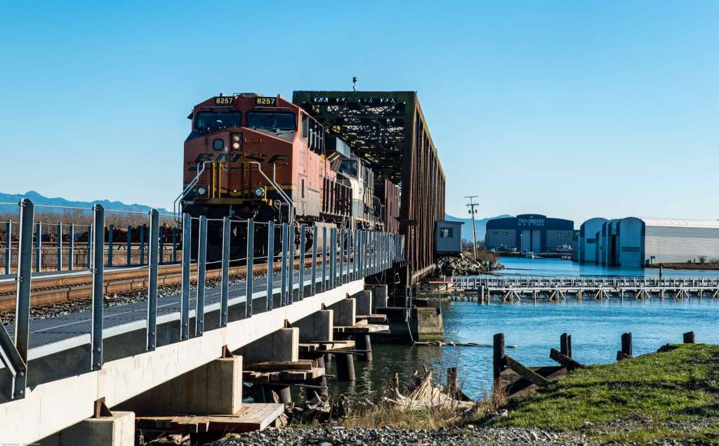
The initial channel rail swing bridge was installed in 1891. The current Swinomish Channel BNSF bridge is a Warren through truss steel bridge with vertical supports. The current bridge was installed in 1953. A 368 foot, 775 ton, swing span was towed on two barges by tugs from Seattle to the north end of the Swinomish Channel, a distance of roughly 65 nautical miles.
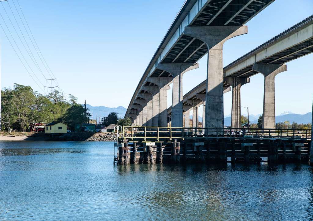
A quarter mile south of the rail swing bridge, two twinned highway bridges also span the Swinomish Channel. In the image below, lofty Twin Bridges carry State Route 20 high above the Swinomish Channel. The Twin Bridges were built in 1981. The bridges are 75.5 feet above the water. The channel separates the Skagit County mainland, on the far side, from Fidalgo Island. The tall concrete bridge piers are protected from errant boats by a structure called a dolphin, lower right.
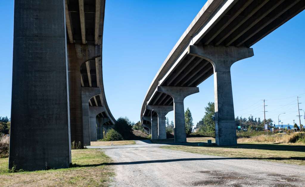
The Twin Bridges make a sweeping curve on the Fidalgo Island side of the channel. State Route 20 crosses the Swinomish Channel on high soaring concrete bridges. Eastbound lanes are on the left and westbound lanes are on the right in the image below.
La Conner, WA – Rainbow Bridge. In 1869, J. D. Conner bought the trading post in what was then known as the settlement of Swinomish, named after the Swinomish Tribe that lived nearby. The following year, Conner changed the name to La Conner in honor of his wife, Louisa Ann. The town used her first and middle initials in its name. La Conner is a charming, touristy, resort town on the eastern shore of the Swinomish Channel. Across the channel, the town and headquarters of the Swinomish Indian Tribal Community sits surrounded by fir trees on Fidalgo Island.
La Conner is nine miles west of Mt Vernon. The Skagit farm country between Mt Vernon and La Conner grows dairy cows, corn, potatoes, and tulips and daffodils. In late March and early April each year, La Conner provides tourist housing and dining for visitors from all over the world to the Skagit Valley Tulip Festival. The Rainbow Bridge offers a beautiful photo subject for visitors and residents, alike.
Fidalgo Island is separated from the mainland of Skagit County by the Swinomish Channel. The Rainbow Bridge, a fine steel bridge that arches like a rainbow across the Channel, connects the small tourist town of La Conner to Swinomish Village, the headquarters of the Swinomish Tribe. July, 2018.
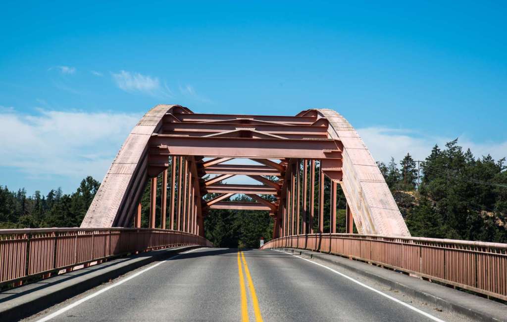
The Rainbow Bridge connects the town and the tribal community, the mainland and the island. The steel deck arch bridge, built in 1957, is 797 feet long with a clearance of 75 feet above the water. The bridge was originally painted orange, but has faded in the sunlight and rain to a quiet shade of delicate pink. A walkway permits pedestrians to walk across, carefully. The sidewalk is pretty narrow and the traffic isn’t slow. At times, the traffic stops and its possible to take a shot of the bridge standing on the double yellow lines, as in the image above.
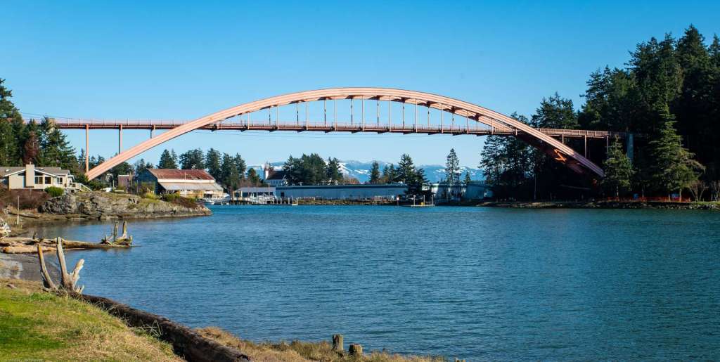
A day in mid-February, 2020, was sunny and bright in western Washington, a welcome respite from the winter rain. The Rainbow Bridge, arching over Swinomish Channel from La Conner, on the right in the image above, at the western edge of Skagit County, to the Swinomish Tribal Indian Community on Fidalgo Island, on the left. The steel deck arch bridge is 75 feet above the water in the channel.
The south end of Swinomish Channel connects with Skagit Bay, situated between Whidbey Island and the Skagit County mainland, near the Skagit River delta. The next post in this series on Pacific Northwest bridges will look at bridges on the Skagit River.
Categories: Bridges