Bridges connect people and places. Like bridges elsewhere, northwest bridges span waterways, railroads, and other spaces. In the Pacific Northwest, bridges sometimes move from one place to another. Washington State Route 20 begins at US 101, 13.2 miles southwest of Port Townsend, on the northeast top of the Olympic Peninsula. The drive takes about 20 minutes. State Route 20 stops at the Port Townsend Ferry Terminal, on Puget Sound. To cross 7.3 miles of Puget Sound and continue east, the state of Washington provides a movable bridge, a vehicle and passenger ferry.
The MV Salish currently serves as the movable bridge across Puget Sound between the Olympic Peninsula and Whidbey Island. The ferry takes just under an hour, depending on the weather, and costs less than $25.00, based on the size of the vehicle you drive, and how many passengers you have. It is also possible to walk on at either end.
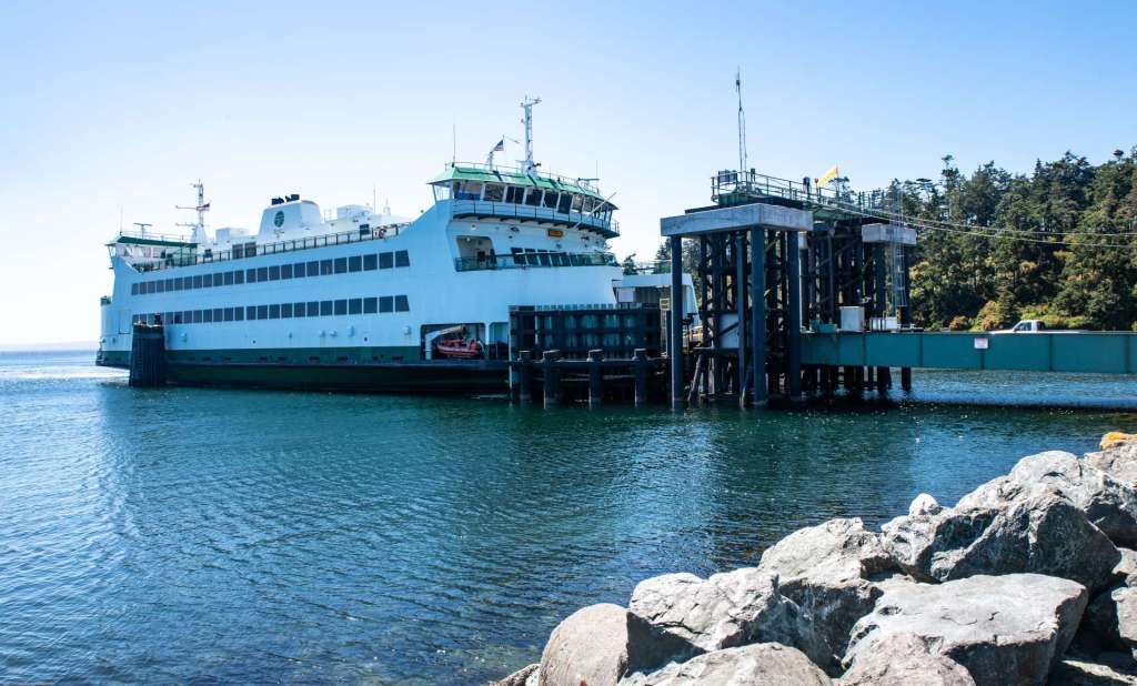
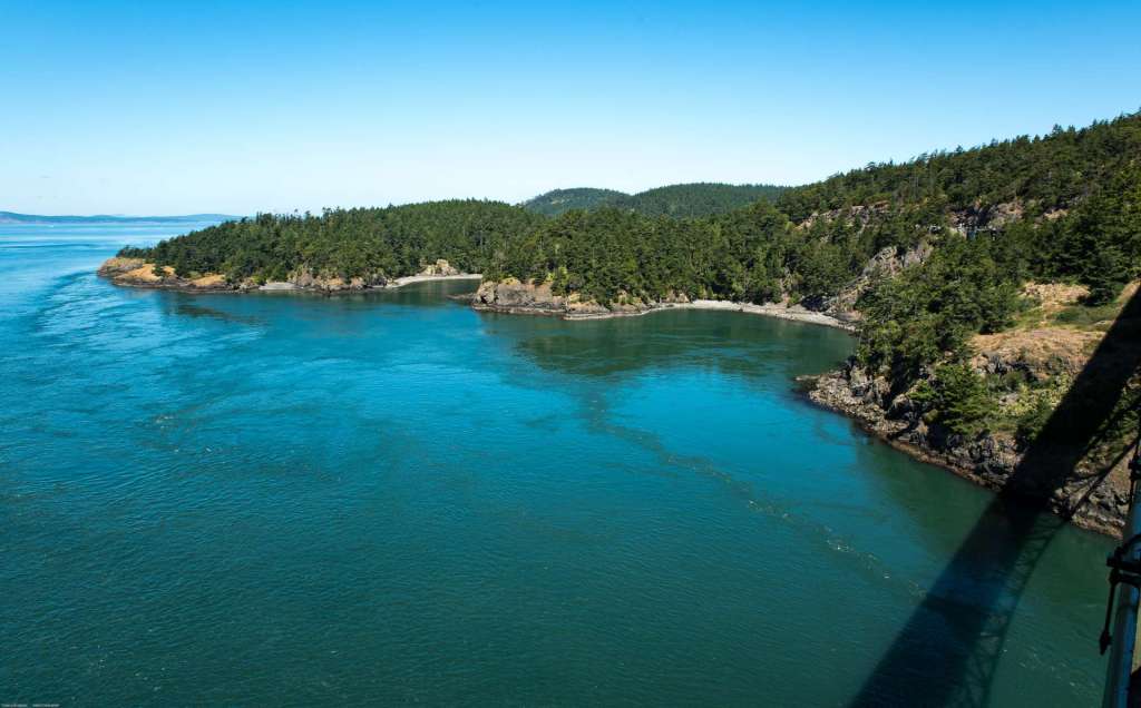
The MV Salish, built in 2011, is part of the Washington Ferry system. In the image above, the ferry docks at the Coupeville dock near Ft Casey Historical State Park. The Salish sails between Port Townsend, on the Olympic Peninsula, and Coupeville, on Whidbey Island several times each day. She is the connection for a segment of State Route 20. The Salish can carry 64 vehicles and as many as 748 passengers. From the dock at Fort Casey State Park on the western shore of Whidbey Island, State Route 20 turns right from the dock and travels ten miles (16 minutes) to Coupeville. SR 20 heads east, then north past the US Navy’s Outlying Landing Field (OLF), an auxiliary field for the Naval Air Station Whidbey Island. The highway then turns west to Coupeville. Folks who are willing to travel a local road can turn left after disembarking from the ferry, and go north four miles, about eight minutes, to Coupeville.
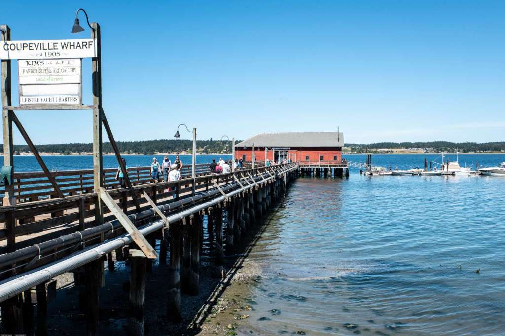
Coupeville is a charming, historic little town on Penn Cove, on the eastern shore of Whidbey Island. This is the second oldest community in Washington state and some of the downtown buildings are over a hundred years old. It deserves a more detailed visit by this blog in the future. For now, though, the Coupeville Wharf should be mentioned in a blog about bridges.
The Coupeville Wharf on Penn Cove was built in 1905. The supporting pilings and decking planks have been replaced from time to time, but the structure is basically the same as it was over a hundred years ago.The red building at the end has a gift shop, a cafe, and the skeletons of a porpoise and a small whale suspended from the ceiling. Coupeville sits astride State Route 20.
The road north from Coupeville passes through Oak Harbor and on to the deep gap between Whidbey Island and Fidalgo Island. State Route 20 rides across Deception Pass on two long, arching bridges that leap across Deception Pass and Canoe Pass. The narrow passage called Deception Pass was named by Joseph Whidbey, for whom the Island was named. Whidbey was Captain Vancouver’s chief navigator. Whidbey, master of the Discovery, sailed through the passage in the spring of 1792, believing it led to a safe, calm bay. Instead, he found that it was a pass between the Strait of Juan de Fuca and Saratoga Passage, a body of water between the island and the mainland connected to Puget Sound to the south.
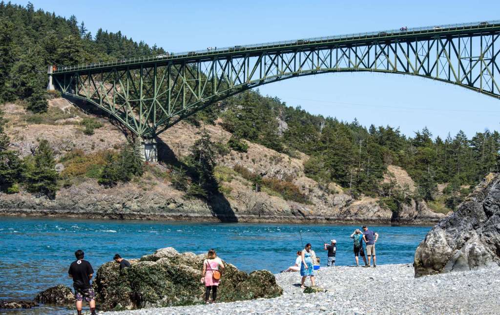
Deception Pass Bridge soars loftily above Deception Pass between Pass Island on the left and Whidbey Island. The steel deck truss arch bridges were completed in dedicated in July, 1935. The bridge decks are about 180 above the water, depending on the tide. Before the bridges were built, a small ferry traversed the passage at irregular times. A traveler arriving at the shore would bang on a saw and wait for the ferry to come. The gravel beach of Whidbey Island below the leaping bridge offers plenty of space for fishing in the swift ebb and flow of the tidal current between the islands.
This view from the sidewalk on the west side of the bridge offers a view of the fast flowing current below. Pass Island is in the center of the image. Canoe Pass is just beyond Pass Island. The lofty Deception Pass Bridge leaps from Whidbey Island on State Route 20, behind the camera, to Pass Island, center of the image.

The view from the Deception Pass Bridge is extraordinary. To the northwest, the view extends past Lottie Point and Lighthouse Point. In the image below, Pass Island is on the right, at the far end of the shadow of the bridge. Lottie Point is in the center of the image. Lighthouse Point is at the left.

The image above looks east from Deception Pass Bridge. Deception Pass Bridge soars high above the fast-flowing, blue-green current of Deception Pass. Looking east from the bridge, the fir clad slopes and sheer, rocky shoreline of Pass Island, lower left, are prominent in this image. Miller Bay is beyond Pass Island, and above that is Yokeko Point on Fidalgo Island. Center right is a glimpse of Strawberry Island and Hoypus Point, the northern tip of Whidbey Island is upper right. Haze-dimmed, snow-capped Mt Baker is on the horizon at left.

The reddish-orange branch of a madrona tree extends towards Canoe Pass, northern passage of two that are collectively named Deception Pass. Canoe Pass Bridge, draped with white tarps during renovation in 2020, makes a mighty leap to carry State Route 20 from Fidalgo Island, left, to Pass Island, on the right. The mainland of Skagit County can be seen through the pass. This shot was taken from the eastern shore of Lottie Point, which is reached by a narrow footpath, the Lottie Point Trail, that connects by way of the Pacific NW Trail to the Bowman Bay Boat Launch. The trails are winding, narrow, climb up and down rather steep hills, and over fallen logs, and are not accessible by mobility challenged people.
Folks who would like to explore the Lottie Point Trail, or the Lighthouse Trail on the neighboring promontory, can reach these adventure destinations from the parking lot at the Bowman Bay Boat Launch area. The boat launch parking lot is at the end of Bowman Bay Road. About a mile north of Canoe Pass, and just before Pass Lake, Rosario Road is on the left side of State Route 20, for northbound visitors. Coming south from Anacortes, Rosario Road is just beyond Pass Lake. As soon as the traveler turns onto Rosario Road, a left turn on Bowman Bay Road will take one down the hills, through the thick stands of fir trees and cedars, to the shoreline of Bowman Bay.
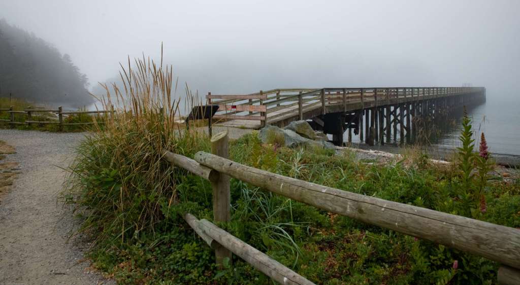
The Pacific NW Trail passes through the Bowman Bay Boat Launch area. The Trail is 1200 miles long, in segments of hundreds of miles, from the Continental Divide to the Pacific Coast. The Pacific NW Trail deserves at least one blog post all its own. The small stretch that runs along the shore of Bowman Bay travels past a weathered, wooden pier that extends into Bowman Bay. The pier is closed because it has deteriorated, and in this image looks like a bridge to a ghostly, unknown place, an abandoned pier that seems to have no end. A weathered log fence outlines the gravel beach of the bay.
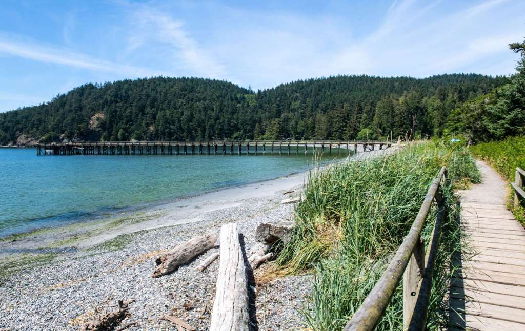
The pier looks different in sunshine. Bowman Bay is a shallow, green cove northwest of Deception Pass. The Pacific NW Trail circles the bay and crosses a wetland on a narrow weathered boardwalk. The Pacific NW Trail starts on the Olympic Peninsula and appears intermittently at scenic spots across the northwest, ending in Montana.
The Port Townsend-Coupeville Ferry, Coupeville Wharf, the two bridges that span Deception Pass and Canoe Pass, the old pier at Bowman Bay, and the segment of the Pacific Northwest Trail, a short distance west of Deception Pass, are how people cross space by ship, and on low wooden bridges and soaring steel structures that are seen on Whidbey and Fidalgo Islands. All of these images and the text are copyrighted by Tom Cochran Vagabond Photography.
More blog posts about bridges and other sights and places in the Pacific Northwest will follow. Thanks for reading, looking, and appreciating the PNW with me.
Categories: Bridges