Everson to Everett
On the Road Again

Over a period of six days, I crossed the Cascade Range on US 2 in central Washington to East Wenatchee, visited dams and bridges on the Columbia River on my way southeast past the Tri-Cities to Umatilla, Oregon, followed the Columbia River along the Oregon-Washington border from Umatilla to Portland, journeyed north on I-5 to the Washington state Capital of Olympia, traveled US 101 to Port Townsend where I visited Fort Worden and Fort Flagler, took the ferry to Fort Casey on Whidbey Island, and saw historic fortifications and cannon emplacements overlooking the entrance to Puget Sound, and followed State Route 20 and I-5 home. Images in these posts are from the current trip for the most part. I added images from earlier trips when it seemed helpful.
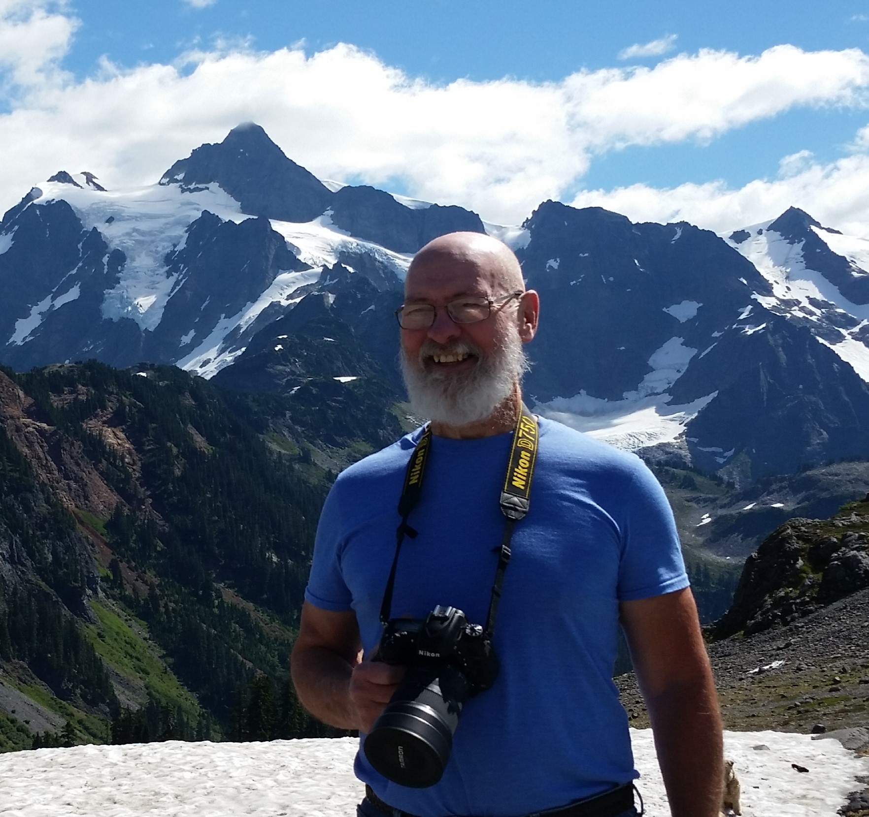
I started this journey ten miles south f the Canadian border, some 43 miles west of Mt Baker, in the northwest corner of Washington state. The first day led me through the Cascades to East Wenatchee on the Columbia River.
The Cascades
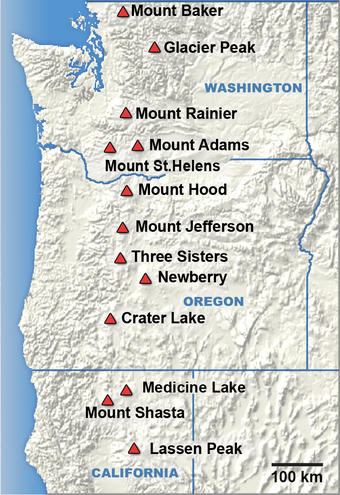
Before I talk about my journey, I want to briefly describe the Cascades. The Cascade Range runs from southern British Columbia down through Washington state and Oregon, to Lassen Peak in northern California, and includes tall, snow-capped volcanic peaks, an area some 700 miles long and 80 miles wide. West of the Cascades are well-watered, fertile farm lands and majorities of the populations of Washington and Oregon. Urban areas, such as the large continuous metro spaces around Seattle and Portland, alternate with suburban and rural places. East of the Cascades, high, dry plateaus extend to the horizon, high desert that is irrigated by water from major rivers – the Columbia, Spokane, Yakima, and Snake in Washington, the John Day and Deschutes in Oregon.
Some high peaks in the North Cascades, like Mt Baker, Mt Rainier, Mt St Helens, Mt Adams, and Mt Hood, are snow-capped most of the year or all year long. The high North Cascades are crossed by Washington Pass (SR 20, closed four or five months each year), Stevens Pass (US 2, the route I took on this trip), Snoqualmie Pass (I-5), and White Pass (US 12, sometimes winter closed) in Washington. However, the only real break in the long parade of mountains is the Columbia River Gorge east of Portland and Vancouver, Washington. The Gorge, the result of multiple massive, ice age floods from the Columbia Plateau, cuts between Mt Adams and Mt St Helens in Washington and Mt Hood in Oregon.
Bellingham
From northwestern Washington, I drove south through Bellingham and continued on I-5. Blog posts focused on Bellingham and each of the other cities mentioned in this series are forthcoming. Bellingham sits on a sweeping curve of Bellingham Bay. Hardworking fishing boats, speedy small cruisers, and elegant yachts occupy the harbor. Tour boats offer whale watching and, in other years, tours to Victoria, BC. Two lovely lakes, Whatcom on the east and Padden to the southeast, offer swimming, kayaking, and grassy lawns for blanket lying and Frisbee throwing. Western Washington University and Whatcom Community College provide academic opportunities and technical skills training. Parks are plentiful. People are friendly.
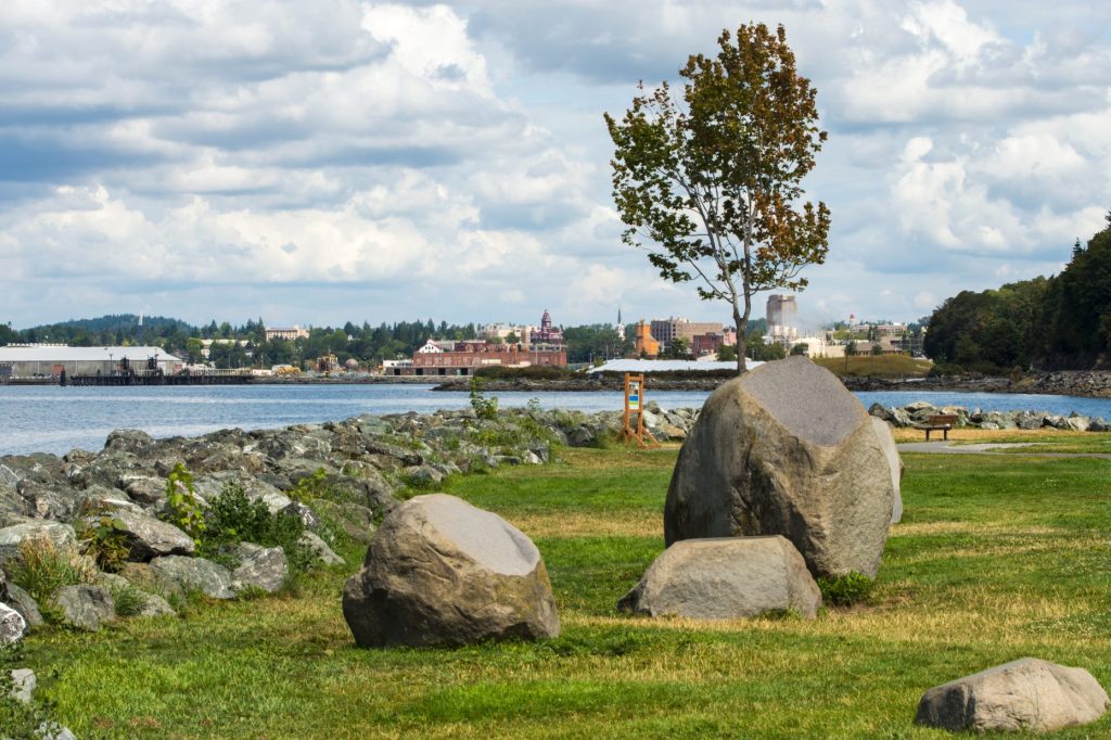

Bellingham’s waterfront and the downtown buildings can be seen from Boulevard Park, a short distance across Bellingham Bay. Two determined children carry a heavy bucket of water from the blue waters of Bellingham Bay to their construction site on the sandy beach of Bellingham’s Boulevard Park.
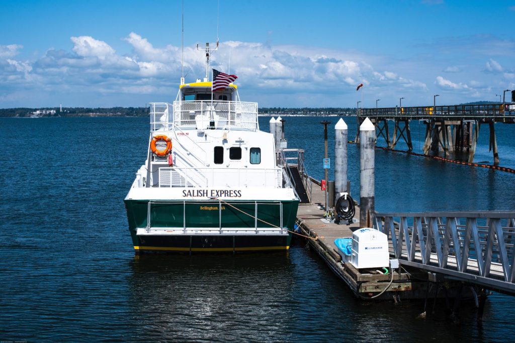
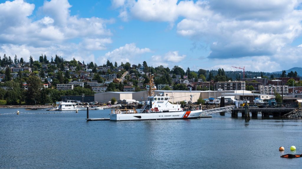
The MV Salish Express is tied to the dock at its home port in a deep blue Bellingham Bay under azure sky in Bellingham. The dock on the right serves the Alaska Ferry. The USCGC Terrapin is docked at the Bellingham Marina near the Bellingham neighborhood of Fairhaven.
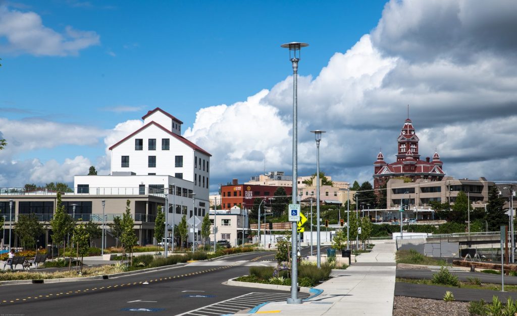
The historic granary building, the white building on the left, was built in 1929 for the Washington Egg and Poultry Co-op and remodeled in 2018. It is now home to several cafes and shops as part of Waypoint Park. The flat-roofed red building beyond it was a warehouse that is now the Bellingham Cider Company. Bellingham City Hall, the red building with the clock tower, was built in 1892. It is now the Whatcom County Museum. Other Bellingham images live at Tom Cochran Vagabond Photography.
Burlington
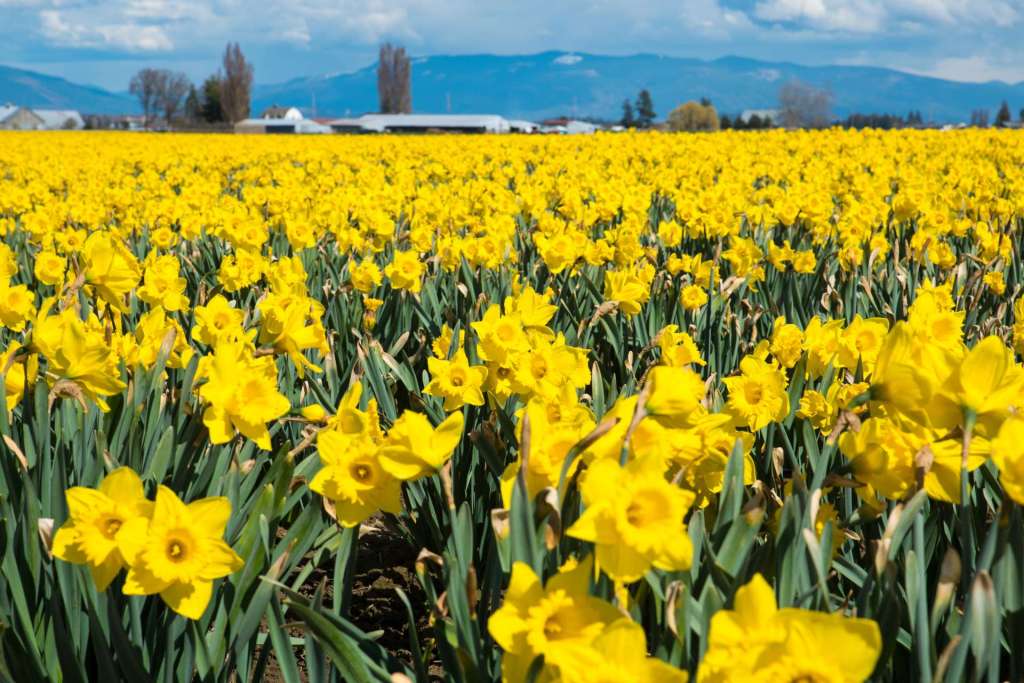
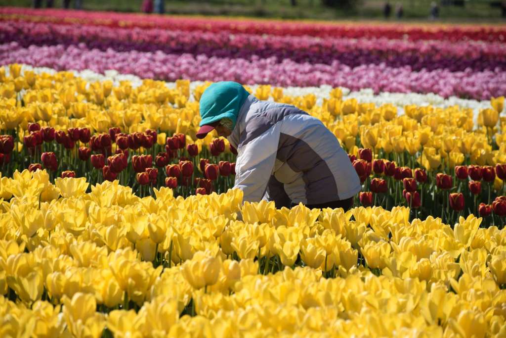
South of Bellingham, I-5 passes through Burlington and across the Skagit River, to Mt Vernon. The Skagit Valley west of Burlington and Mt Vernon is mostly flat, and very fertile. The good brown dirt grows berries, corn, potatoes, and a variety of other crops. Dairy farms abound. In mid-March, golden daffodils blanket acres of farmland, to be replaced in early April by glorious rainbows of tulips and visitors of all ages who ride tractor-drawn wagons or measure the mud puddles between showers.

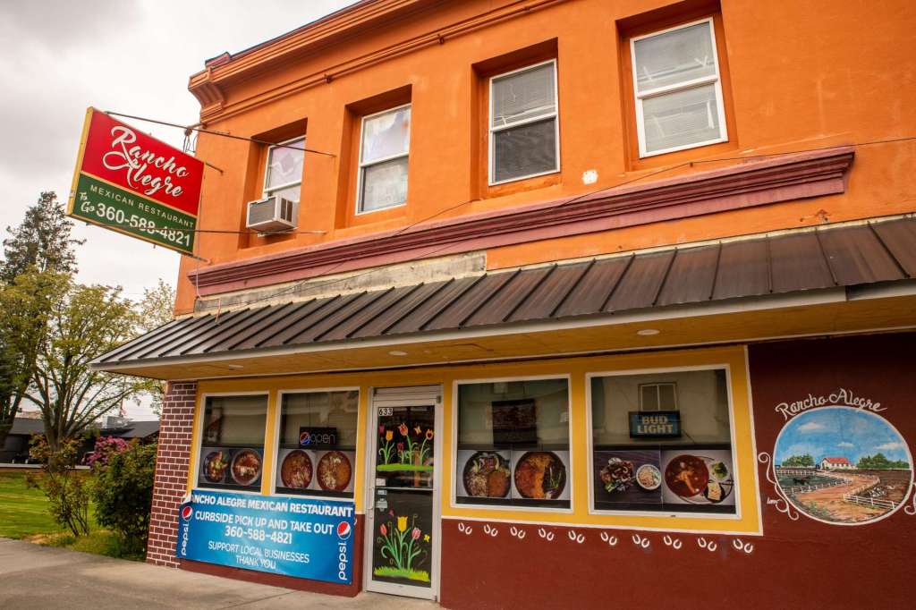
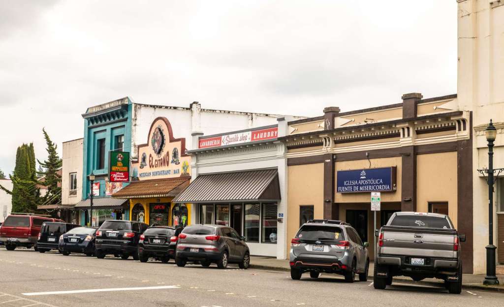
The farm land north and west of Burlington draws agriculture workers for seasonal jobs, and many of those workers stay permanently. Many of the agricultural workers have Hispanic origins. In 2018, the Hispanic population of Burlington was just under 30% of the total of 8,743. East-west Fairhaven Avenue is the original downtown business district, though most of the shopping, including the Cascade Mall, stretch along north-south Burlington Boulevard, the principal thoroughfare. Several businesses and organizations focus on the Hispanic residents, including good Mexican food restaurants, line Fairhaven Avenue.
Burlington hosts a residential community sponsored by Seasonal Farmworker Housing of Skagit County and funded in part by the USDA. These residences, not tents or small shacks, but new, town house style, one- and two-story houses, are a recognition that many farmworkers travel and often work with their families. The almost new community in the images below is at the east edge of Burlington, near the Skagit River.
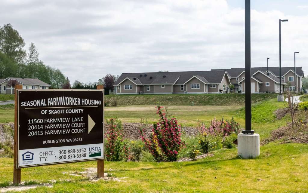
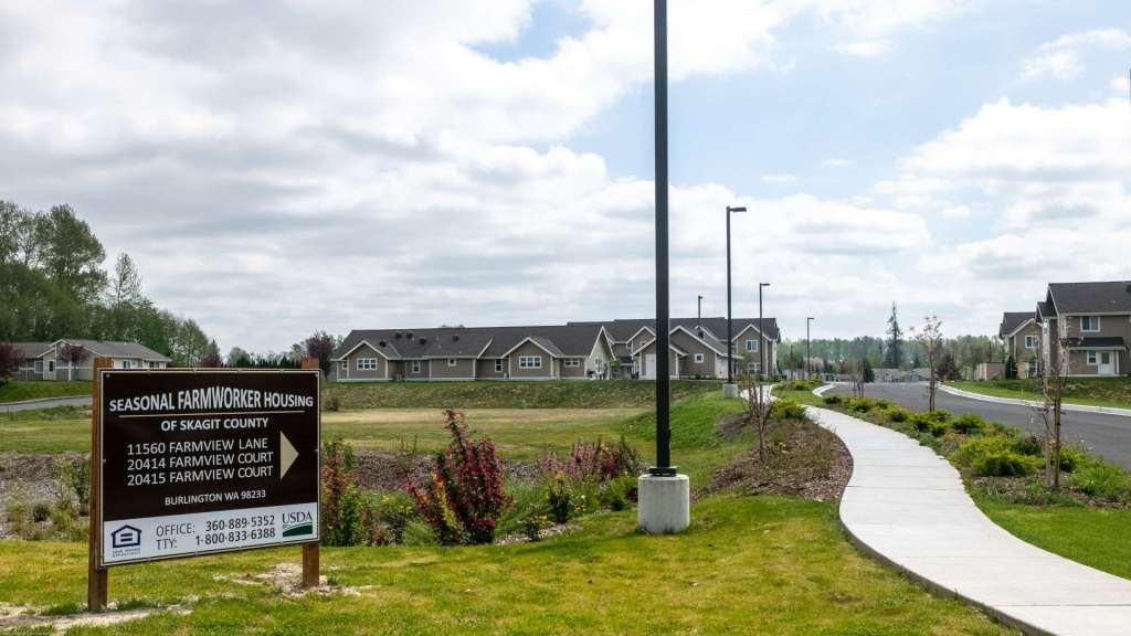
The Skagit River flows down from the North Cascades, winding west through the Skagit River Valley to Burlington, where it loops south, then west, forming the boundary between Burlington and Washington. Over the years, the Skagit River has flooded the Skagit Valley, including Burlington. The Burlington Dike follows the river, protecting the town and offering a hiking and cycling trail with views of the River and the Skagit River Park and Sports Playfield.
Mt Vernon
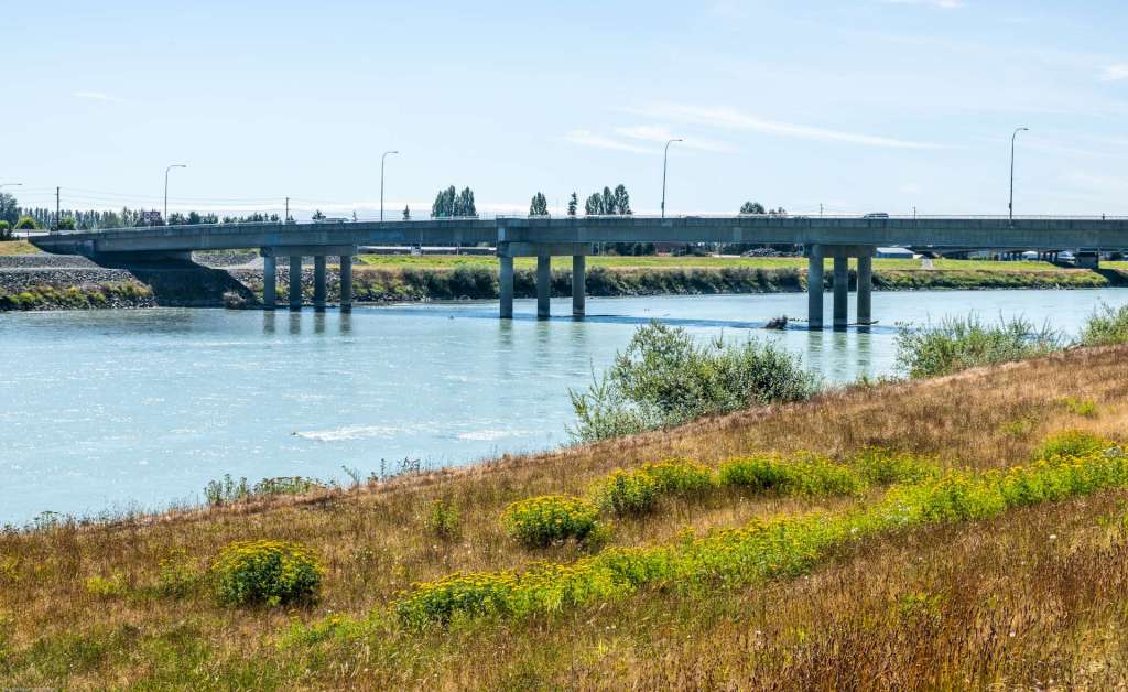
The Skagit River is the border between Burlington and Mt Vernon. Two bridges connect the cities across the Skagit, the I-5 bridge and the Burlington Boulevard-Riverside Drive bridge. The first and second segments from the near shore of the I-5 Skagit River Bridge, on the left with wide concrete piers, collapsed on May 23, 2013. The steel superstructure was struck by an oversized load and severely damaged. Three people in cars fell into the river and were rescued without injury. A replacement was installed on September 14-15, 2013. Traffic was temporarily rerouted over the nearby Burlington Boulevard bridge, on the right below. Although there were no deaths directly from the collapse, Washington State Patrol Trooper Sean O’Connell was killed when his motorcycle collided with a truck as he was directing detour traffic to the Burlington Boulevard bridge. The replacement I-5 bridge was named to honor the service of Trooper O’Connell.

Mt Vernon has a population of about 32,000. Skagit Valley College, a public community college, has its principal campus in Mt Vernon. The college offers two bachelor’s degrees (applied management and environmental conservation) and associate’s degrees and coursework in a variety of studies, including basic education, health sciences, industrial technology, and public services. Classes in English acquisition are useful for some farmworkers whose primary language is other than English. The tulip fields, popular tourist attractions in the spring employ many of those farmworkers.

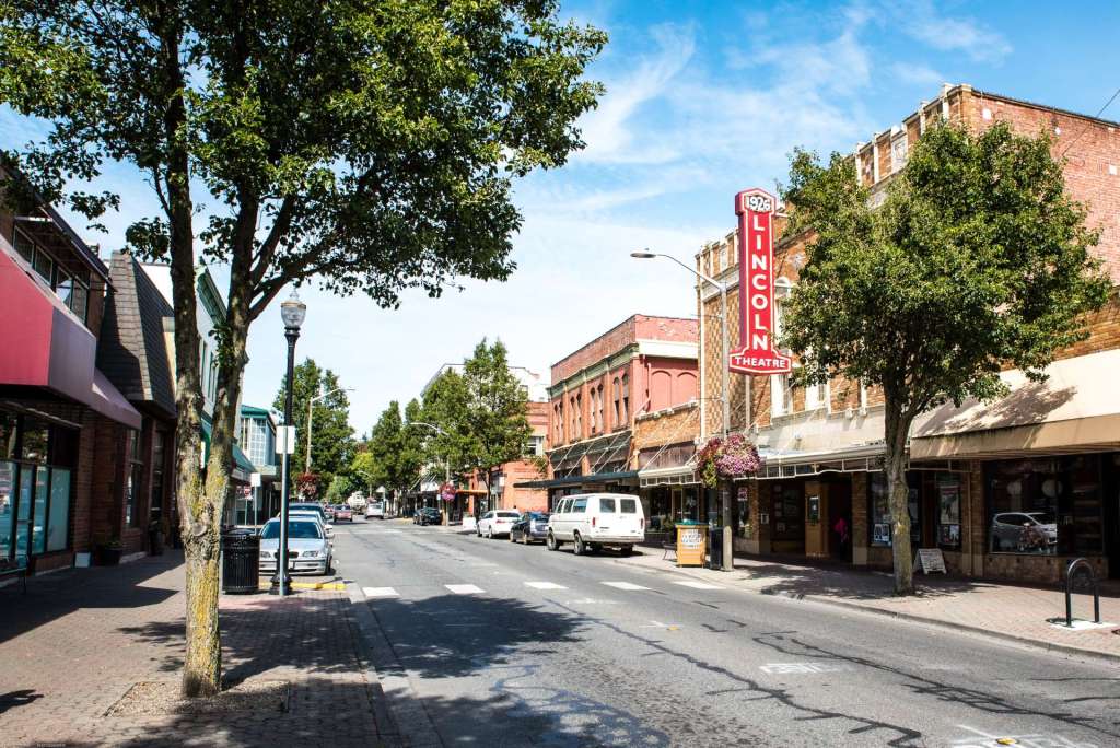
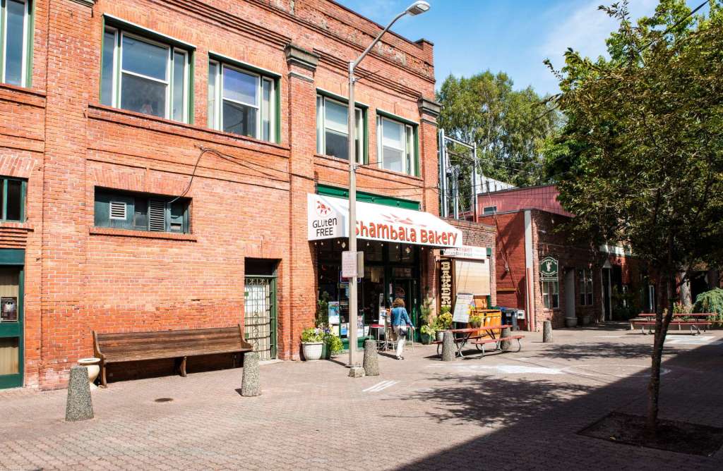
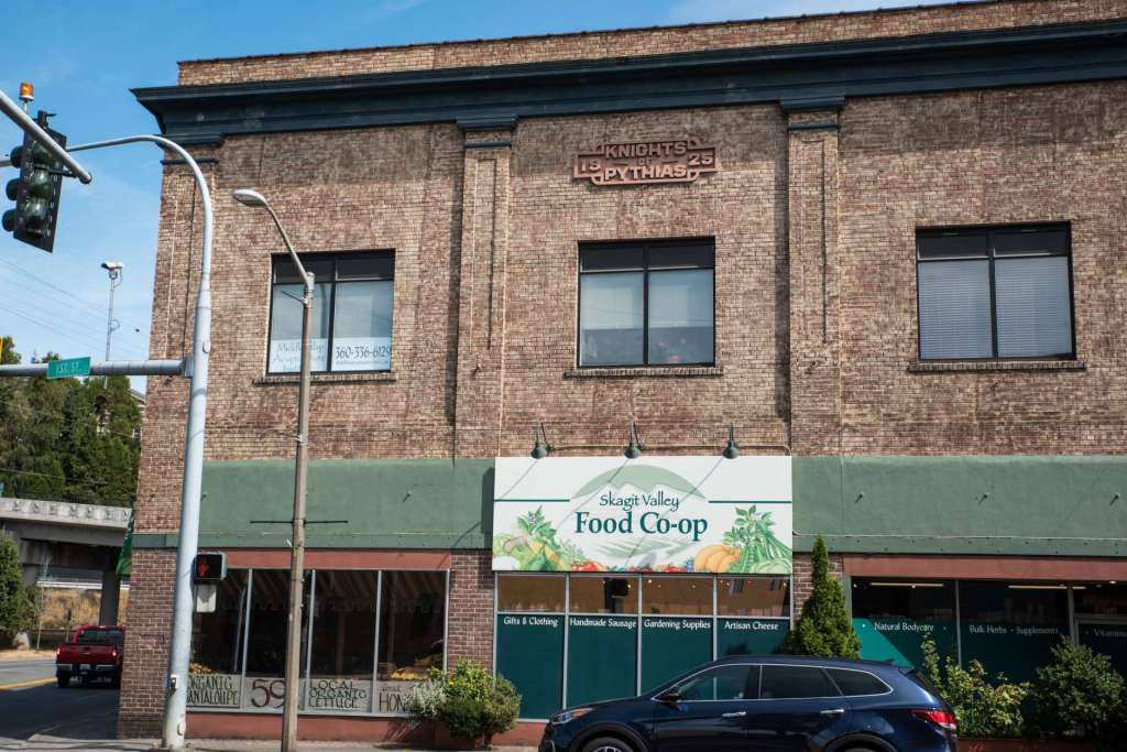
The old downtown area, just a block or so from the Skagit River, is lined by two-story brick buildings. The Lincoln Theater on South 2d Street dates to 1926. Small shops and cafes occupy a brick paved pedestrian mall, created from a block of Pine Street. The Skagit Valley Food Co-op, on Division Street between 1st and 2d, is less than a block from I-5.

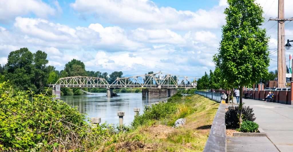
A block west of the Co-op, the Skagit River winds south past downtown. The Division Street Bridge crosses the Skagit River from downtown to the farm and tulip fields to the west. The Skagit River Walk parallels the River, providing a pleasant space for walking and stroller pushing.

More Mt Vernon images are waiting for you here.
Arlington
South of Mt Vernon, I-5 passes Arlington, at the intersections of State Route 530 and I-5, State Route 530 and State Route 9, and at the confluence of the North and South Forks of the Stillaguamish River. Arlington is described in a series of blog posts called State Route 530. The old intersection of the Whitehorse Express and the Seattle, Lake Shore, and Eastern railways is a short walk north of the river confluence. Arlington is both a gateway to the history of Snohomish County and a link to the future.
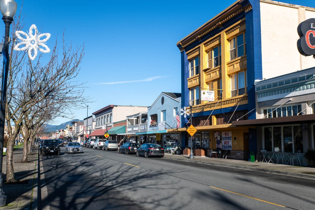
Olympic Avenue in Arlington was originally called Railroad Avenue. Centennial Trail, on the road bed of the historic SLS&E Railway (later the NP) is a half block to the left of Olympic. The downtown core on Olympic is only six blocks long. The blue and yellow building is the American Legion.
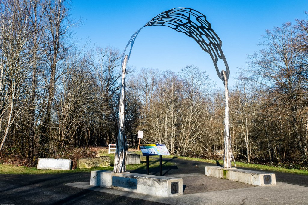
This silvery arch, molded to look like two trees with interwoven branches, stands at the intersection of two trails that run on historic railway roadbeds, just north of the Stillaguamish River in Arlington. The Centennial Trail, on the left, runs north and south. It was the the SLS & E line, then the NP line. The Whitehorse Trail in the center curves off to the east, past Oso to Darrington, on the former road bed of the S&I, which became part of the NP.

State Route 530 begins at I-5 and passes east through Arlington, Washington. Just beyond the northern city limits of Arlington, SR 530 steps across the South Fork of the Stillaguamish River, known locally as the Stilly. SR 530 continues east, past the Oso Slide Memorial, to Darrington, then north to Rockport.
South of historic Arlington on I-5, a traveler will pass Marysville, on the way to Everett. Approaching Everett from the north on I-5, a city of 110,000, the highway crosses Ebey Slough then Steamboat Slough, two short waterways that look like wide enough to be rivers. At low tide the sloughs become mudflats. Past Steamboat Slough, a large lumber yard with huge stacks of seasoning logs, and then a sales and storage yard for dozens of water craft – fishing boats, yachts, cruisers, and outboards. The highway climbs to the city, sitting on the edge of a bluff and overlooking the winding Snohomish River. A short distance south of the edge of the city, an off ramp ducks under I-5, the beginning of US 2. US 2 starts at I-5 and continues to east, spanning 2,571 miles across the northern tier of US states. My journey on US 2 through Monroe, Sultan, Stevens Pass, and Leavenworth to Wenatchee is described in the next installment, Cascades, Columbia, Capital, and Cannons – 2.
You’re invited to join me.
The text and all of the images in this blog, except for the Google maps and the common source USGS map, are copyrighted by me, dba Tom Cochran Vagabond Photography.
Sources

2 replies »