A journey around the state of Washington offers a traveler busy big cities, pleasant small towns, sandy ocean shores, dense green forests, magnificent mountains, fertile farms, and sweeping bridges. People working, people playing, people entertaining, people thinking. This post looks at some of the beauty and wonder of the people and places in a trip that circles Washington state.

We begin our journey in the upper left corner of the state, just below the Canadian-US border, not far from Vancouver, BC and Blaine, Washington. I took a look at Blaine as a Roadside Community on I-5 and right on the border in a previous post at Roadside Communities – Part 1.
Day 1 – Whatcom County to Olympia
The far northwest county of the far northwest state of the contiguous states, is Whatcom County in Washington State. Whatcom County was named for a Nooksack Chief. The name means noisy water. Whatcom County stretches from the shore of the Strait of Georgia east along the Canadian border, and into the high peaks of the North Cascades.

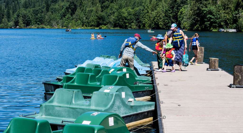
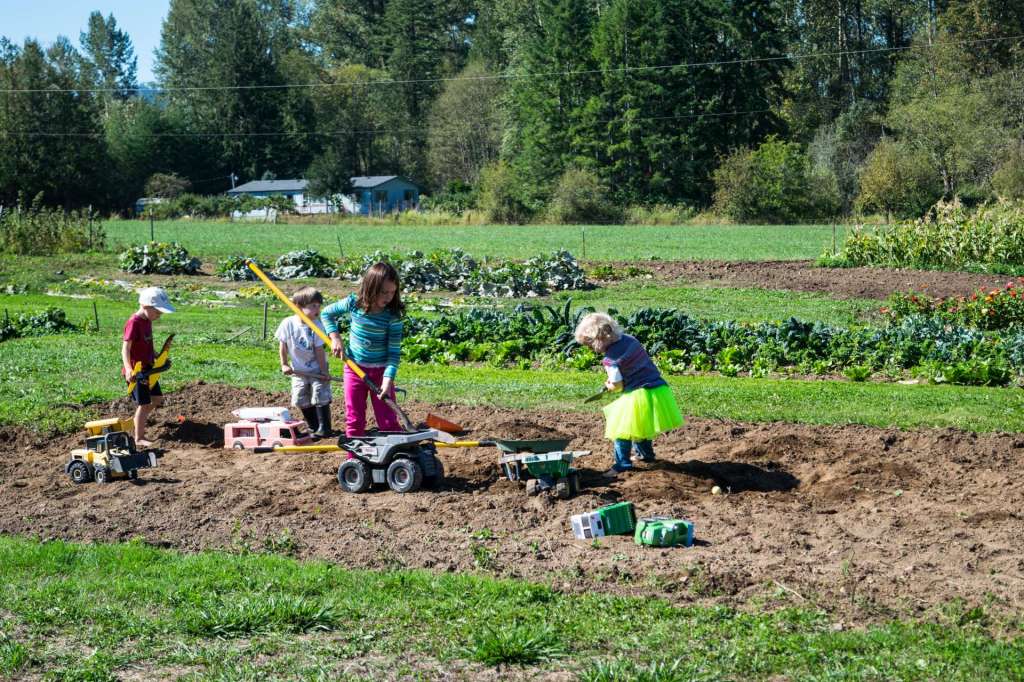
I started this journey at Silver Lake Park, a county park tucked into the western foothills of the North Cascades. The park covers 410 acres and includes 5.75 miles of trails. Rainbow trout and cutthroat trout are available in the lake. The park offers camping and cabins, fishing and pedal boating. Reservations for cabins and some of the campsites are required. Pedal boats offer fun for all ages on the Lake.
In this shot of the dock at Silver Lake, a protective father extends his hand to help his young son board a paddleboat for a family voyage around Silver Lake. Before walking onto the dock, the parents had reminded each child to don a hat, protection on a sunny summer day, and checked the straps on the children’s life jackets. Riding in a pedal powered boat is like riding a bicycle on the water, an excellent family outing in late.
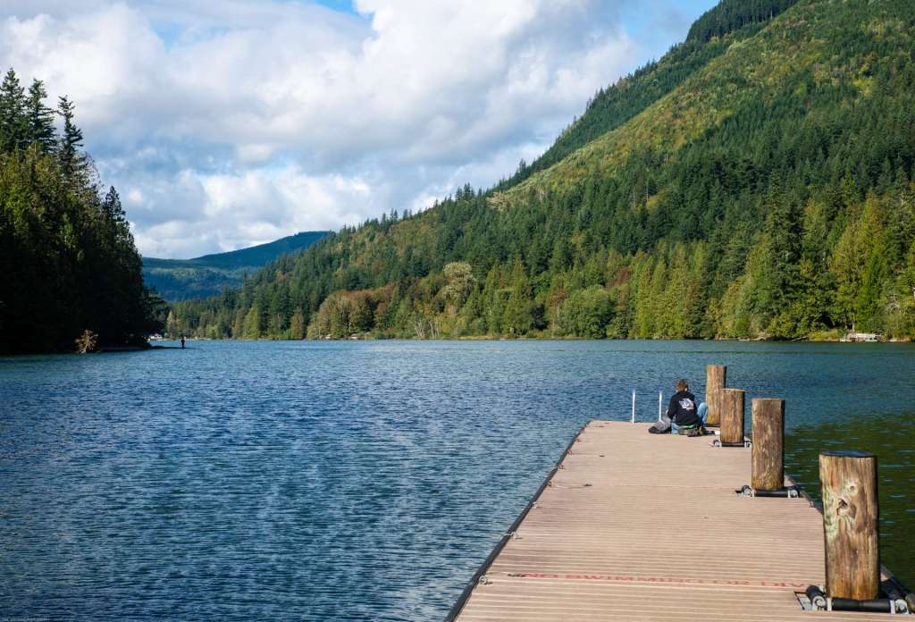
This image of the dock is from late September, when the paddle boats were stored for the winter and there were few people still at the lake. The hills that cup the lake are draped with fir and cedar trees in many shades of green in the autumn. Silver Lake is a deep blue under a partly cloudy sky. I talked to the young fisher at the end of the pier who said he’d just lost a perch. I confessed I did not fish, and he lost interest in our conversation. Can’t say I blame him.
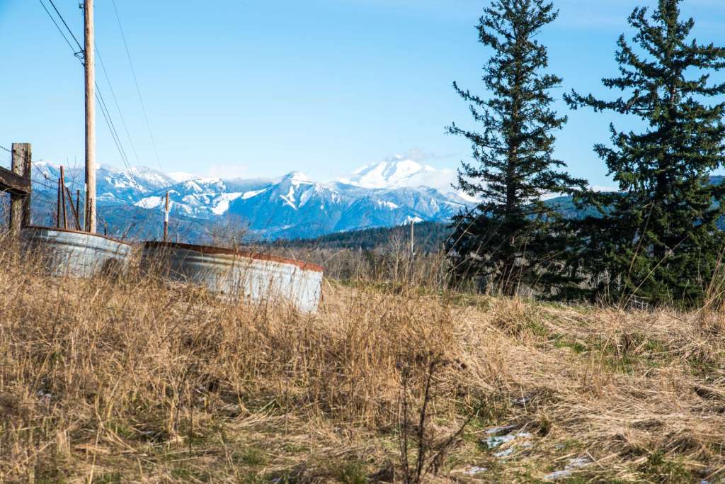
Whatcom County is farm country, as well as a region of blue lakes and green slopes. Berry farms, dairy farms, and farms that grow corn and hay cover most of the county north of Bellingham, between snow-topped Mt Baker and the Strait of Georgia.


Skagit County
South of Whatcom County is Skagit County, home to the Skagit River and spring tulips. I passed through Skagit County on my trip around the edges of Washington state, but did not stop on that trip. I will visit the Skagit River and the tulip fields in other posts. I’ll add links to those posts later. For now, here is an image of the Division Street Bridge and Skagit Riverwalk in Mt Vernon, on the left, and a shot of A Flower Among the Tulips, on the right.


Snohomish County
Snohomish County is south of Skagit County. Arlington, Washington sits next to I-5 in Snohomish County. Sixteen miles east of Arlington on State Route 530 is the Oso Slide Memorial. In March, 2014, the Oso Slide, the most deadly mudslide in US history, ended the lives of 43 children, women, and men, and destroyed at least 49 homes and other buildings. I’m working on my first blog post describing the background of the Oso Slide. It will be posted on PNW Vagabond soon. A collection of my images about the slide is at Oso Washington.
Washington State Route 530 connects Arlington to Darrington, to the east, and then north to Rockport in Snohomish County. State Route 20 begins on the Olympic Peninsula, travels by ferry to Island County, then east to the North Cascades, passing through Burlington, Sedro-Woolley, Concrete, and Rockport on the way to the high peaks. Together, SR 20 and SR 530 make a loop that takes in a good deal of northern Snohomish County from the Salish Sea to the North Cascades, encompassing coastal fishing grounds, fertile farm land, timbered hills and mountains, and important rivers – the Skagit, the Stillaguamish, and the Sauk.
South of Arlington, the city of Everett sits on a hill above the Snohomish River, overlooking Possession Sound to the west, an arm of Puget Sound between Whidbey Island and the Snohomish County mainland. Like the counties to the north, Snohomish County stretches from the waters of the Salish Sea to the high peaks of the North Cascades. Snow-capped Glacier Peak is near the eastern boundary of the county. Glacier Peak, an active volcano, is only 70 miles from downtown Seattle, closer than Mount Rainier, and has produced some of the largest and most explosive eruptions in the state of Washington.
Everett is the northern-most sizable city of a large, continuous metropolitan area along I-5. The Seattle Metropolitan Area includes Snohomish (Everett, King (Seattle and suburbs and Bellevue), and Pierce (Tacoma) counties with a 2019 population of almost four million people, over half of Washington’s population, and the 15th largest metro area in the country.
Seattle
Posts on this region will be added over time. My collection of images of the Seattle area are here. In the first image below, the Seattle Police Harbor Patrol docks just west of Gasworks Park on the north end of Lake Union. West of the police dock, a fleet of large tugs, including the Nokea, the Pacific Challenger, and the El Lobo Grande II, waits to move large, sea going vessels in Lake Union, Lake Washington, and Elliott Bay. The Aurora Street Bridge spans the Fremont Cut of the Lake Washington Ship Canal. Most of the structures at Gas Works Park, across Lake Union from downtown Seattle, are old and rusted. The pipes at the picnic and play area are cheerful and gaily painted. The play area was the pump house for the former Seattle Gas Light Company gasification plant. Alki condos in the upper right image are in West Seattle, across Elliott Bay from downtown Seattle.
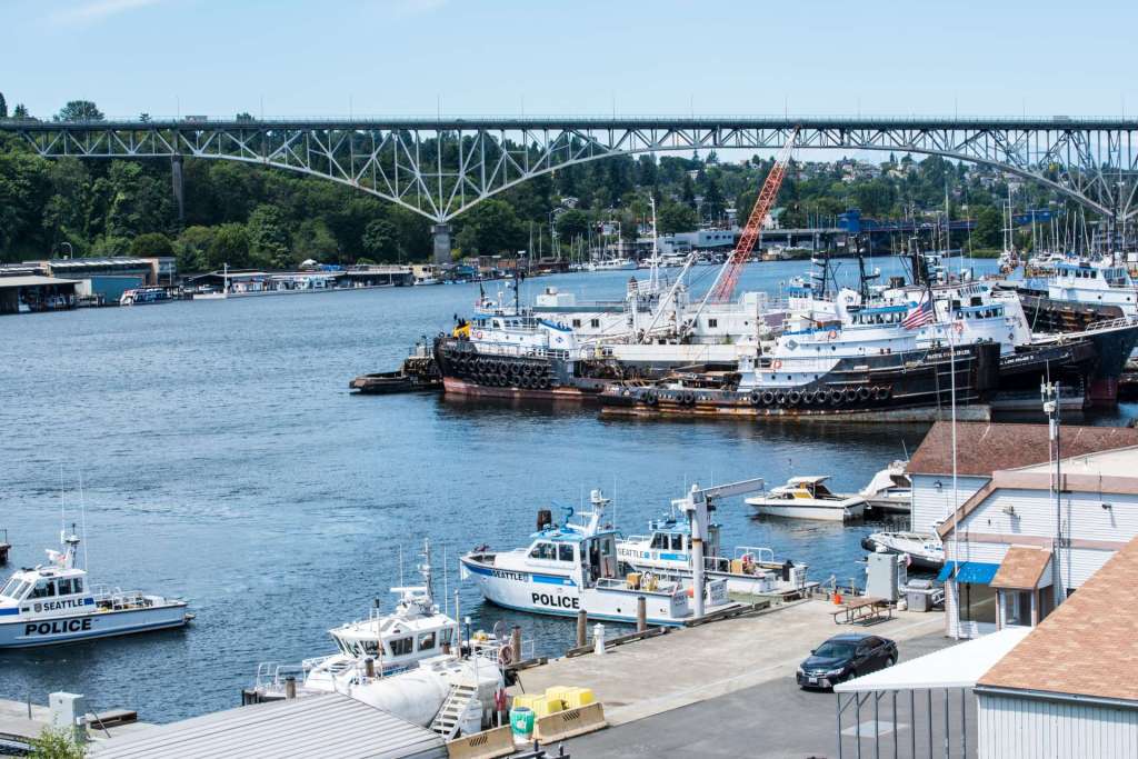
Harbor Patrol and Tugs 
Play Area at Gas Works Park 
Alki Condos 
Ivy Tanks and Hanging Sneakers 
Island Storm
In the lower left image, above, rusted tanks at the former Seattle City Light gasification plant overlooking Lake Union support trees, shrubs, and energetic ivy. The industrial age succumbs to the wild growth of nature. The site is now Gas Works Park, with green fields and hills for rolling down. Sneakers hang from a high wire, forever out of reach. On the right, the tug Island Storm shoves a massive barge loaded with sand across Elliott Bay. The Seattle Space Needle watches the progress of the tug with envy, wishing that it, too, could sail across the Bay and out into the world beyond.
Billy Frank Jr Nisqually Wildlife Refuge
On this journey, I continue south past Seattle, through Tacoma, and paused at Billy Frank Jr Nisqually Wildlife Refuge. Billy Frank Jr was a member of the Nisqually Tribe. The tribal reservation is located on the Nisqually River, some nine miles north of Olympia, in western Washington. Frank was an environmentalist and fishing rights advocate. He led a series of “fish-ins” that resulted in the 1974 Boldt decision which affirmed that Washington indigenous tribes are entitled to half of the catch each year, and the right to co-manage fishing in the state. Frank was a bridge between indigenous and Western societies, and was awarded the Presidential Medal of Freedom posthumously for his environmental advocacy.
The Wildlife Refuge was named for Billy Frank Jr in 2015. The Refuge occupies historic farmland created by the Brown Farm Dike. The Nisqually River empties into the Nisqually Reach, an arm of Puget Sound. The river delta, where fresh water meets salt water, creates multiple natural habitats, including salt marshes, mud flats, freshwater marshes, grassy meadows, and forests. Images of the fertile, green Refuge are below.

Green Ditch and Visitor Center 
Pond and Shadow 
Nisqually Boardwalk 1 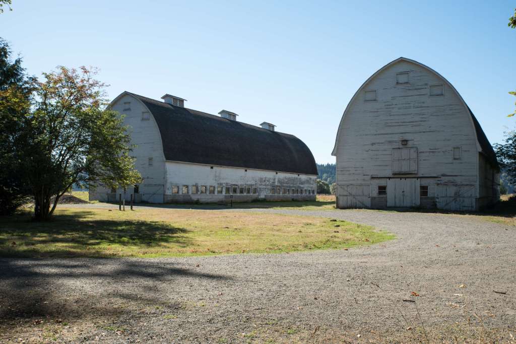
Twin Barns at Nisqually 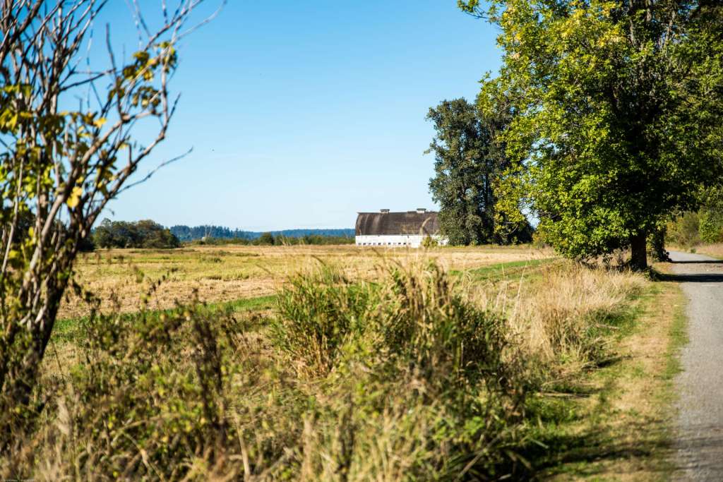
Path to Twin Barns 2
The Refuge has five miles of trails, on boardwalks across marsh land, on dirt and gravel paths near arable farm land, through sun-dappled forests, on observation decks above pea soup swamps. It’s a great place for a camera or binoculars. The trails are almost all level and easily accessible by folks with mobility challenges. There are covered observation decks and periodic benches for admiring the day. The Billy Frank Jr Nisqually Wildlife Refuge is worth whatever time you can devote to a visit. On January 17, 2021, the parking lot is limited and restrooms are closed in response to Covid-19 restrictions. Those restrictions could be reduced later this year.
Olympia
The next several exits from I-5 south of the Nisqually Refuge lead to Olympia, the Capital of the state of Washington. There are at least two locations in Olympia that should be high on a traveler’s list of places to see. One is the downtown/Historic District. Another is the Capitol campus. We’ll discuss each location in more detail.
Olympia, population about 52,000 in 2020, adopted its name in 1850. The capital is located at the foot of Budd Inlet at the far southern end of Puget Sound. The area was once the hunting and fishing grounds of several indigenous tribes, primarily the Nisqually, Duwamish, Chehalis, and Suquamish.
Take the Martin Way exit from I-5 and turn right, west, at the bottom of the exit ramp. The first intersection is College Street. Saint Martin’s University is a block south on College. Saint Martin’s University was founded by the Catholic Benedictines in 1895. The school now offers 28 bachelor’s degrees and 14 graduate degrees. I want to take a moment here to mention the other centers of higher learning in Olympia, Evergreen State College and South Puget Sound Community College (SPSCC).
Evergreen State College is unique in Washington in its approach to education. Narrative assessments that include discussions between faculty and individual students imitate extra-academic job evaluations. Students ordinarily do not choose majors, but Paths of Study that layer multiple fields of study. Evergreen offers a first class liberal arts education, and pays special attention to students who are veterans.
SPSCC is a traditional community college that offers technical classes for certificate programs and academic classes for university transfer.
Continuing west on Martin Way from I-5, the road splits to become two one-way streets a block apart. The right lanes become west-bound State Avenue. The east bound street is 4th Avenue. State Avenue continues west past small, frame, single family residences, many of which are decades old. The street follows a hill down to the downtown/old town part of the city, and past Budd Inlet. Budd Inlet is divided by a small peninsula into West Bay and East Bay.
In the image below, a marina, including a series of docks and boat shelters, is on the west side (on the left in this image). In the center of the image are two vessels. A Washington State ferry is in front of a log freighter with long crane arms that extend above and beyond the ferry. A small fishing boat and several recreational cruisers are also tied up in the bay.

A dock and .9 mile cedar plank boardwalk run along the east shore of West Bay, up to a grassy area called Percival Landing Park. Artistic sculptures and statues people the boardwalk. Summer brings fresh fish and clams, eating next to Budd Inlet in Olympia on warm evenings, and buskers playing on the wharf next to downtown.
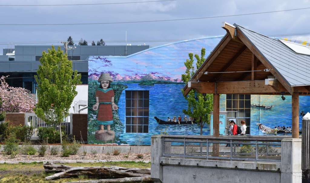
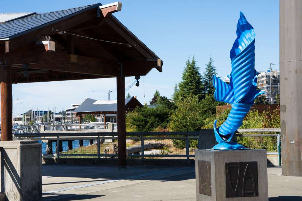
A mural of a Nisqually woman and tribal cedar canoes on Budd Inlet decorates the wall of a building in downtown Olympia, fronting on West Bay. The waterfront walkway that is part of Percival Landing Park passes between the mural and an observation deck on the water. The roof of the structure imitates tribal buildings. A bright azure blue, twisted steel sculpture, made from pieces of corrugated culvert pipe, stands on a pedestal on the West Bay of Budd Inlet near Percival Landing Park.

Heritage Park Fountain welcomes visitors, especially the young at heart, south of West Bay, across 4th Avenue. The fountain includes a spray park that can cool and refresh children of all ages.

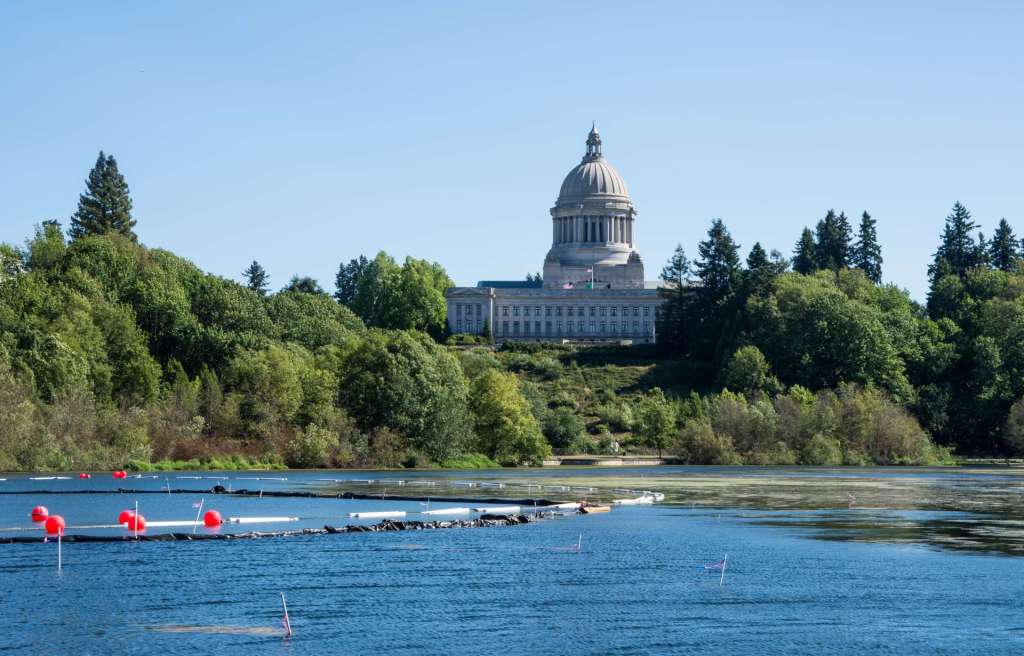
South of the spray park, Capitol Lake Park invites visitor to the path around Capitol Lake. The iconic State Capitol sits high on a hill above Capitol Lake. A view of the Washington State Capitol across Capital Lake, below. The red balls are floats for a boom that is part of an algae cleaning project on the lake.
I spent the first night of my journey around the state of Washington in a motel near the Capitol. I was up early, took several shots of the Capitol, inside and out, add breakfast with my son, then set off on the second leg of my trip, which took me along the Columbia River. The segment of my Ring Around Washington will be in Part 2 of this series of posts.
All of the images in this post, and in all my posts, are copyrighted. If you’re interested, you’re welcome to look at my collections. The links in each photo or in the captions will take you to the home of those images. Please feel free to wander around at Tom Cochran Vagabond Photography. See you soon.
Categories: Ring Around Washington, Washington State Journeys