State Route 530 isn’t long, only 51 miles from Interstate 5, crossing State Route 9 that runs north to the Canadian border, past Arlington, Washington, east past Oso, through Darrington, then north to Rockport on the Skagit River. The first post in this series of posts about State Route 530 looked at Arlington and the four miles between I-5 and SR 9. The current post travels the 28 miles of SR 530 from Arlington, past the Oso Slide Memorial, to the town of Darrington on the Sauk Prairie, cupped by high, snow-capped peaks of the North Cascades.
The Road through Arlington
State Route 530 begins at I-5. The clover-leaf interchange with SR 530 is four miles west of Arlington. SR 530 travels east from the interchange, parallel with, and a short distance south of the Stillaguamish River. Just west of the City of Arlington, SR 530 loops to the north, then makes an S-curve east to meet State Route 9 as it travel north towards the Canadian border. A stoplight at SR 9 enables travelers to go straight into Arlington on Division Street. The old downtown shopping area is on the right, on South Olympic Avenue, just past the first roundabout. Division Street is named for the divide between historic Haller City and Arlington.
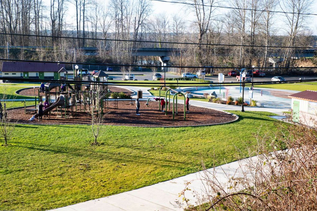
Haller City is now Haller Park, a grassy, family-friendly space along the Stillaguamish, and just below the Centennial Trail bridge that once carried the Northern Pacific Railway. Images below, clockwise, are Haller Park in Arlington, Centennial Trail Bridge over Stillaguamish River, Haller Park in Arlington, Centennial Trail and Whitehorse Trail, Two Trails Meet.


SR 530 can be reached by a three-quarter spin around the second roundabout on Division Street, and taking Broadway north to Burke. A right turn on Burke will put you back on SR 530. The highway actually turns left at the light and keeps company with SR 9 for a couple of blocks before turning right on Burke and running through Arlington.
Whether a traveler turns onto Burke from SR 9 or takes Division Street to the second roundabout and then Broadway to Burke, Burke Avenue will become SR 530 as it leaves town. Before it does, a traveler will pass a Grocery Outlet, the bronze-domed St Andrew Orthodox Church, and the Cascade Division of the Snohomish County District Court. Beyond the District Court, the road curves down and to the left as it crosses the South Fork of the Stillaguamish River.


At the east edge of Arlington, the road curves broadly, then heads north and east, twisting and turning, over hill and dale, and up in altitude. Arlington is at 115 feet above sea level, and Darrington, tucked into a deep valley among snow-capped peaks, is at 554 feet.
SR 530 runs north after it crosses the South Fork. The road passes Twin Rivers Park on the left and is briefly next to the South Fork on the right. The Country Charm Conservation Area is to the east of the river. The South Fork bends around the Conservation Area on the north, then curves to the south, towards the mountains. The Conservation Area was purchased by the City of Arlington in 2010 from the Graafstra family who used the land for their Country Charm Dairy for many years. The area includes 100 acres of open space and 40 acres of riparian land. The City plans to develop the area as a park with camp sites.

Northeast of Arlington
SR 530 skirts the Country Charm Conservation Area on the far side of the South Fork. From there, the highway travels north and east, where it meets the North Fork of the river, then turns east at Oso to continue to Darrington. Along the way, the road twists and curves, following and occasionally crossing the North Fork of the Stillaguamish River. The valley of the Stillaguamish River begins west of Arlington, broad, flat or gently rolling farm fields between low hills. As the valley reaches east, it narrows, and low hills become snow-capped peaks. Whitehorse Mountain, at 6840 feet, overlooks the valley, the river, Darrington, and SR 530.
Cicero
Seven miles northeast of Arlington, SR 530 crosses the North Fork of the Stillaguamish at a location that was once called Cicero. Cicero is now more a memory than a recognizable community. The first European settlers, Mr. and Mrs. Ralph Collingwood came to the area in 1884. The small group of houses built near the Collingwood’s orchard was called Harmony. Charles Hillis came to the valley in 1896, and later built a road from the county road to his farm. That road is still called Hillis Road. The Stillaguamish River valley in the vicinity of the historic community of Cicero. At this point in the valley, wide, pastures and modern commercial farms are the rule. A modern paved Hillis Road is at the left in the right hand image below.


The railroad began operation in 1901. Northern Pacific extended a spur line from Arlington to Darrington to carry timber from the mountains to cities on and near the coast. When the railroad reached this region of the valley, Mr. and Mrs. Cicero built a post office on their land near the tracks. Mrs. Cicero became the first postmistress. After some dispute, people on both sides of the river agreed to call the settlement Cicero.
The Stillaguamish valley is beginning to narrow at this point, but the farms are still large, with broad fields for hay and corn, and pastures for dairy cattle. The image below is looking back west, towards Arlington, from the turnout at the Cicero SR 530 Bridge.


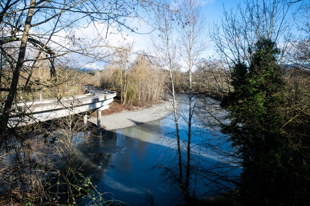
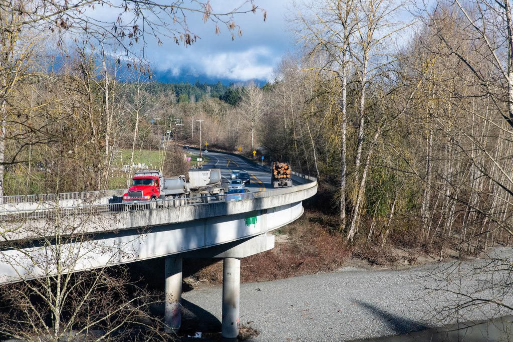
State Route 530 crosses the North Fork of the Stillaguamish River on the Cicero Bridge between 300th Street Northeast and Hillis Road, 7.6 miles from Arlington. Just west of the Cicero Bridge, a parking area on the right of the highway (for eastbound traffic) provides access to the Whitehorse Trail which parallels the highway from Arlington to Darrington. The Whitehorse Trail runs on the roadbed of the historic Northern Pacific Railway.
The first image below is the Cicero Bridge, State Route 530 over North Fork. Both bridges are shadowed by the hills that line the south side of the valley, to the right of the highway. Difficult to see in that deep shadow is an abutment on the right side of the arched highway bridge. That abutment, and a matching structure on the near side of the river, are the remnants of the Hilderbrand Bridge, built in 1896 by Ben Hilderbrand in anticipation of the road that was planned through the valley. That road, which is now SR 530, was build in 1897, after Hilderbrand’s death. The steel arch SR 530 bridge seen below was built in 1966.
The middle image shows both the highway bridge and the Centennial Trail Bridge. When I parked to take this shot, an ambulance was leaving the parking area. A cyclist was standing near the bridge, holding her bike. A second bike was on the ground next to her. She called to me, and warned that the bridge deck was very slick. She said her friend had slipped on the bridge, even though she was walking, and that they had called the ambulance for her, just to be safe. she said her friend did not appear to be hurt, but her age warranted caution. I took her advice and did not walk on the bridge. The image on the right is the Whitehorse Trail Bridge at Cicero on a warmer, dryer day.


As SR 530 travels east beyond Cicero, space for large, commercial farms dwindles, replaced by small family farms with a few head of dairy or beef cattle and perhaps some chickens. Wide green meadows and pastures are replaced by small lots, sometimes simply muddy yards, grass beaten down by just one or two penned cows.
Houses change from elegant, two or three story, multi-room residences to small, one-story, wood frame homes or permanently anchored mobile homes that are tucked away from the highway behind woodlots, down lanes that are often twin, muddy ruts. Small houses often have thick clumps of moss on the roof and have not seen a fresh coat of paint in years. Houses, barns, and other outbuildings that don’t have moss-decorated roofs usually have corrugated steel roofs that are more rust than steel. As the highway moves east, the areas around these small homes sometimes have several old cars and pickups of questionable mobility. Occasionally, old appliances share the yard with faded, plastic children’s pedal toys and slides.
Four miles east of Cicero, the old community of Oso is still visible. Four miles beyond the Oso store in the community of Oso is the Oso Slide Memorial and the shattered hillside north of the Whitehorse Trail and the highway. The Memorial describes the March, 22, 2014, tragedy in 43 children, women, and men perished. I write about it in more detail in my Oso Slide posts.

Closer to Darrington, Whitehorse mountain dominates the landscape. The mountain was called So-bahli-ahli in the Lushootseed language of local Salish tribes. It was named Whitehorse Mountain by Darrington postmaster W. C. Hiles in 1894 because a snow patch resembled a horse owned by Fred Olds, a pioneer that the townsfolk were searching for.

The story of SR 530 as it travels through Oso and other historic communities, past the Oso Slide, and farther east towards Darrington will be the subject of subsequent posts in this series. Please stay tuned.
All of the images in this post are available at my Arlington collection and at my State Route 530 collection for purchase as archival paper and canvas prints and on a variety of household items like cups, blankets, and shower curtains. All of the images and text are copyrighted by Tom Cochran Vagabond Photography. Please leave a comment, question, or suggestion. Thanks for reading.
Categories: State Route 530, Washington State Journeys


2 replies »