From Interstate 5 in western Washington to the eastern United States, US 2 runs and climbs and sinks and rambles across the northern states, the northern-most US highway across the country. In Washington state, the road passes through cities and villages, climbs the magnificent North Cascades, winds beside frolicking rivers, and coasts through orchards and among farmlands. Places of beauty and history are the roadmap. This blog post looks at a short stretch of the highway and nearby locations west and north of the city of Leavenworth, Washington. This post is one of a series that drive the highway, glimpsing past and present beside the road, and separate but connected posts that describe in a bit more detail the locations and communities where US 2 lives.
Like the sound of a beating drum, tumwater is an indigenous word that means noisy water. This is Tumwater Canyon on US 2.
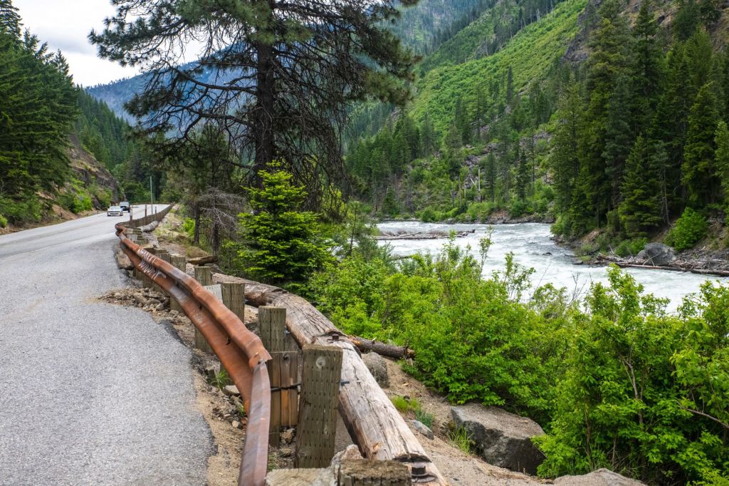
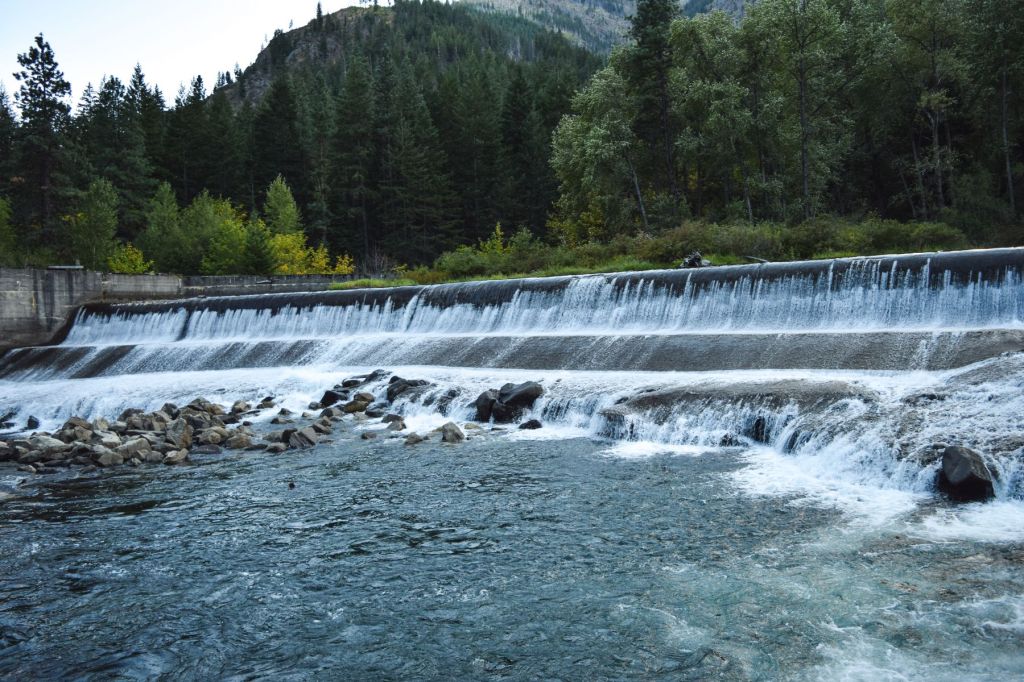
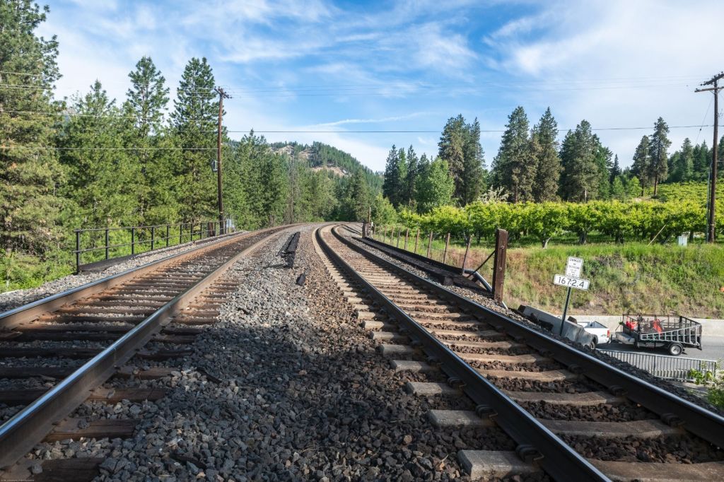
Tumwater Canyon is a narrow, steep-walled canyon that carries the Wenatchee River. The canyon reaches from the Wenatchee River bridge that carries US 2 across the river down to the edge of Leavenworth, a distance of 8.6 miles. Twisting and turning, each curve in the road that runs beside the river opens a new vista of mountain beauty.

US 2 Crossing Wenatchee River – Beginning Tumwater Canyon 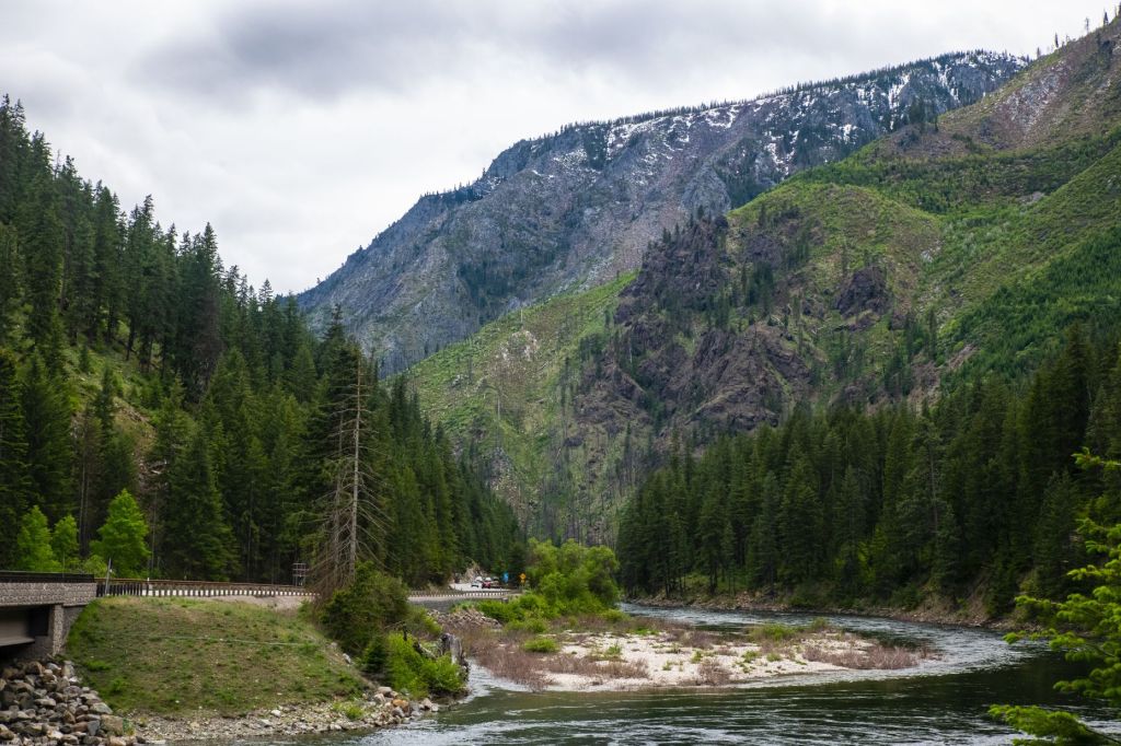
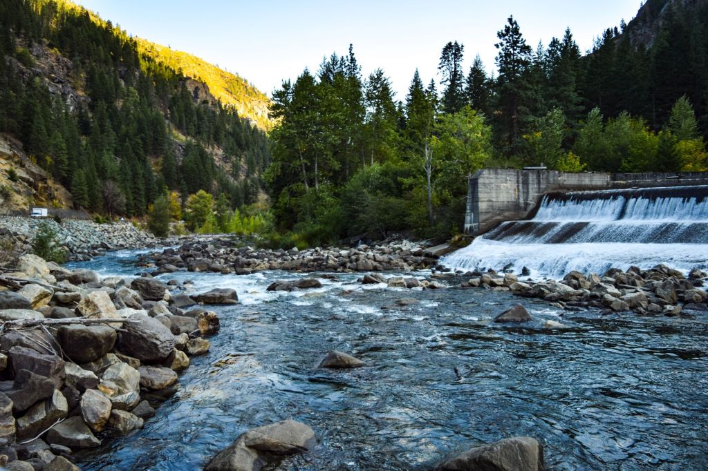
North End of Tumwater Canyon
The Wenatchee River drains Lake Wenatchee about five miles north, left of the image. From here, it winds south (center of the right image) through the steep canyon walls to Leavenworth.
Narrow Tumwater Canyon
The Tumwater Canyon, winding, steep-walled, and narrow is the principal approach to Leavenworth from western Washington state. When John Stevens was surveying a route for the Great Northern Railway, he passed through Icicle Flats the area around the confluence of Icicle Creek and the Wenatchee River and the future location of Leavenworth, and continued up the Wenatchee River to find Nason Creek. Stevens had been told that Nason Creek rose at a pass which would provide a way across the mountains, so Stevens followed that creek to the pass. Stevens pass was subsequently named for him.
Tracks were laid from Wenatchee to Stevens Pass in 1892. The route followed the path surveyed by Stevens. The location of the shots below is midway up Tumwater Canyon from Leavenworth. The canyon is narrow enough that the road has no shoulders for most of its length through the canyon. The Great Northern tracks originally ran where US 2 now travels.


The two images above were taken from the same location, looking south down Tumwater Canyon, four years apart. The image on the left was shot in September, 2017, at a time that smoke from wildfires drifted above the river and pines were often charred skeletons. The image on the right was shot in August, 2021, and trees, grass and shrubs on the far side of the Wenatchee River are green again.
CR & TN Railroad
On July 4, 1884, the Chumstick River and Tumwater Northern Railroad completed a 30-inch wide track from Icicle Flats, up the Chumstick Canyon, to Lake Wenatchee, to serve the mines and lumber operations in the area. Grade problems forced the CR & TN to construct a loop, north along the Chumstick River to the small community of Plain, near the southeast tip of Lake Wenatchee, then southwest following Nason Creek to Tumwater Canyon, and back to Leavenworth. A spur line traveled along the north shore of Lake Wenatchee to White River Falls to serve the timber and mining operations northwest of the lake. The map below shows the route of the CR & TN, without the northwest spur, laid over modern roads.
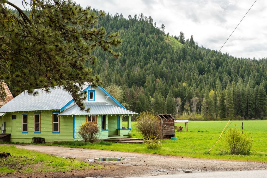
After the timber in the wide, flat valley was harvested, apple orchards were planted area that became Plain, to provide continued financial support to the CR & TN and later to the GN. Charming homes in Plain are below.


Nason Creek at Wenatchee River 
SR 207 Bridge over Wenatchee River, near Plain
The CR & TN, and later the GN, tracks traveled south, to the left in the image on the left above, along Nason Creek to Coles Corner, where the rail bed turned continued south through Tumwater Canyon to the growing community of Icicle, which was renamed Leavenworth. When the tracks were removed, the rail bed through Tumwater Canyon became the bed of US 2. The tracks crossed the Wenatchee River near the present location of the SR 207 bridge that frames the westering Wenatchee, above.
BNSF Bridge and Three Tunnels
In 1892, the Great Northern Railway built a depot and division headquarters at the confluence of Icicle Creek and the Wenatchee River in the Icicle Valley. The rail yard and depot led to the development of Leavenworth and the construction of the Lamb-Davis Lumber Yard at the confluence of Icicle Creek and the Wenatchee River. Great Northern entered a lease agreement with CR & TN to use the right of way. GN’s standard gauge tracks required the laying of a third rail along the shared tracks.

In 1929, Great Northern moved the division headquarters to Wenatchee and rerouted the tracks around Leavenworth to avoid weather and landslide problems in Tumwater Canyon. Great Northern used CR & TN tracks as an alternative to the Tumwater Canyon route. Tracks owned by the Chumstick River and Tumwater Northern Railroad went north along the Chumstick River (or Chumstick Creek, in some sources) through Chumstick Canyon then cut through three tunnels to reconnect with the original route.
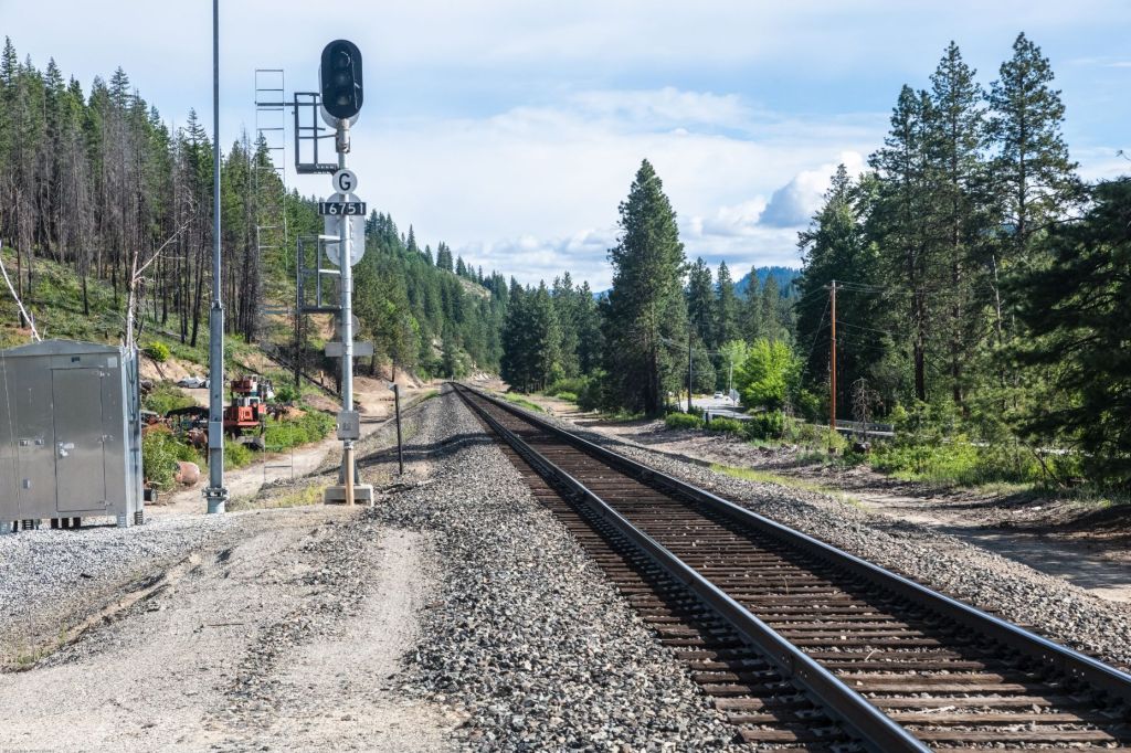
About three miles south of Coles Corner, a rail bridge now crosses the highway. This is the BNSF track, used by BNSF freight trains and Amtrak passenger trains. This BNSF/Amtrak bridge is where the tracks returned to the original route that led over Stevens Pass. The dirt road in the image on the left is just before the BNSF bridge. That dirt lane travels north about a half mile to the Winton tunnel, below. Winton Tunnel is one of three tunnels between Chumstick Canyon and Tumwater Canyon that were used by Great Northern to bypass Tumwater Canyon.

BNSF Tracks crossing US 2 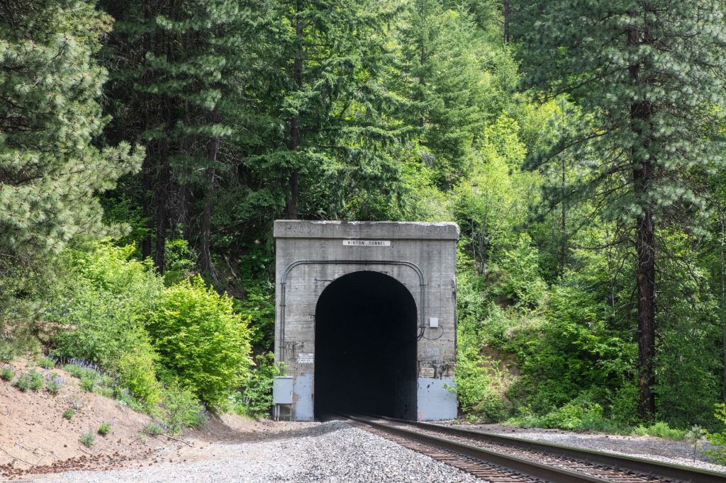
Winton Tunnel, BNSF Tracks – 1/2 mile from US 2
Tumwater Dam and Bridge
A tunnel beneath Stevens Pass was started in 1897 and completed in 1890. The tunnel was necessary because the initial switchback route over Stevens Pass was slow, difficult, and exposed to severe weather. It soon became apparent that the smoke produced by the coal-burning locomotives made travel through the 2.6 mile tunnel difficult if not impossible. The solution was to electrify the tracks and use electric locomotives. The tunnel was electrified in 1909. The Tumwater Canyon Dam, below, diverted water through a penstock, or large pipe, to a powerhouse downriver that produced 5 MW of electricity. The hydroelectric power was used to run the four Great Northern electric locomotives that pulled trains through the first tunnel. When a second, longer tunnel replaced the first, it was also electrified. Electrification was removed in 1956.
The water diverted from the Tumwater Dam, above, flowed through a penstock or pipe across the Wenatchee River to a powerhouse a short distance downriver. The bridge, below, carried the penstock over the river. The penstock was eight feet in diameter and made of wooden staves like barrels. The bridge is now part of the Old Pipeline Bed Trail.

Tumwater Bridge Crossing Wenatchee River 
Tumwater Bridge and Remains of Penstock
Tumwater Canyon in Winter
The North Cascades often receive deep snows in winter. US 2 through Tumwater Canyon can be two or three feet deep until it is plowed. Deep snows and changing economic conditions contributed to re-routing the GN up the Chumstick Canyon and through tunnels to connect with the original track west of Tumwater Canyon. The track used by the Great Northern Railway ran on the road bed now occupied by the highway until 1954.
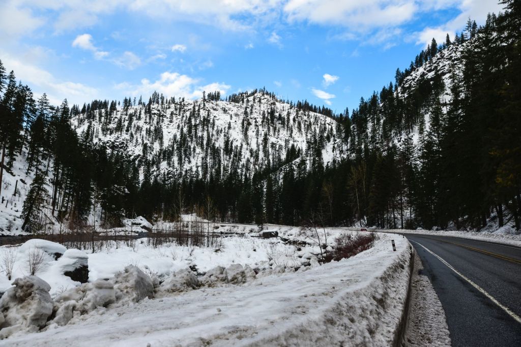


Rocks in the Wenatchee River are frosted by several inches of snow at the end of January, 2016. The snow is almost two feet deep on the shoulder of the road and banks of the Wenatchee River in the images above the rocks. Heavy snows like these often accumulated on the Great Northern tracks that ran adjacent to the river at this point.
Icicle Station
Icicle Station opened in 2009 as the Amtrak passenger depot for Leavenworth. The depot is on the northeast edge of Leavenworth on North Road, at the point where the tracks make a sweeping curve to the north, where it enters Chumstick Canyon. It was this diversion in 1929 that led to a drastic economic decline of Leavenworth. The Bavarian re-construction of Leavenworth was response to that economic hole.
BNSF – Amtrak Curving North towards Chumstick Canyon 
Leavenworth Depot
Chumstick Canyon
The BNSF tracks, below, previously the GN tracks, and before that, the CR & TN tracks, travel north through Chumstick Canyon. The canyon is wider and more level than Tumwater Canyon. The tracks are straighter than in Tumwater Canyon, and this route is now used in both directions by the BNSF and Amtrak trains.
BNSF – Amtrak Tracks in Chumstick Canyon 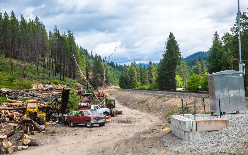
Log Pile Near BNSF Tracks
Gateway to Leavenworth
Tumwater Canyon opens into the west side of Leavenworth. A blog that describes the charming Bavarian-themed city of Leavenworth is under construction and will be published soon.
The images and text in this blog are copyrighted by me as Tom Cochran Vagabond Photography. The images are available for browsing and/or purchasing at US 2 Tumwater Canyon to East Wenatchee. An extended blog describing communities and places along US 2 is also available here.
Sources
Chumstick River and Tumwater Northern
Categories: Tumwater Canyon, US 2

1 reply »