Washington State Route 530 runs northeast from Arlington, past the Oso Slide, to Darrington, where it turns north to Rockport. This post, the fourth in a series on SR 530, looks at the stretch from Darrington to Rockport. The first post in the series, State Route 530, visited the short stretch of the road from I-5 to Arlington, and wandered around Arlington a bit. The second post, State Route 530 – Part 2, extended the visit to the Cicero Bridge and the historic community of Cicero. The third stretch of the highway, from the Cicero Bridge to the Darrington Rodeo Grounds, was traveled in State Route 530 – Part 3 through forests and past small farms beneath glacier-draped Whitehorse Mountain.
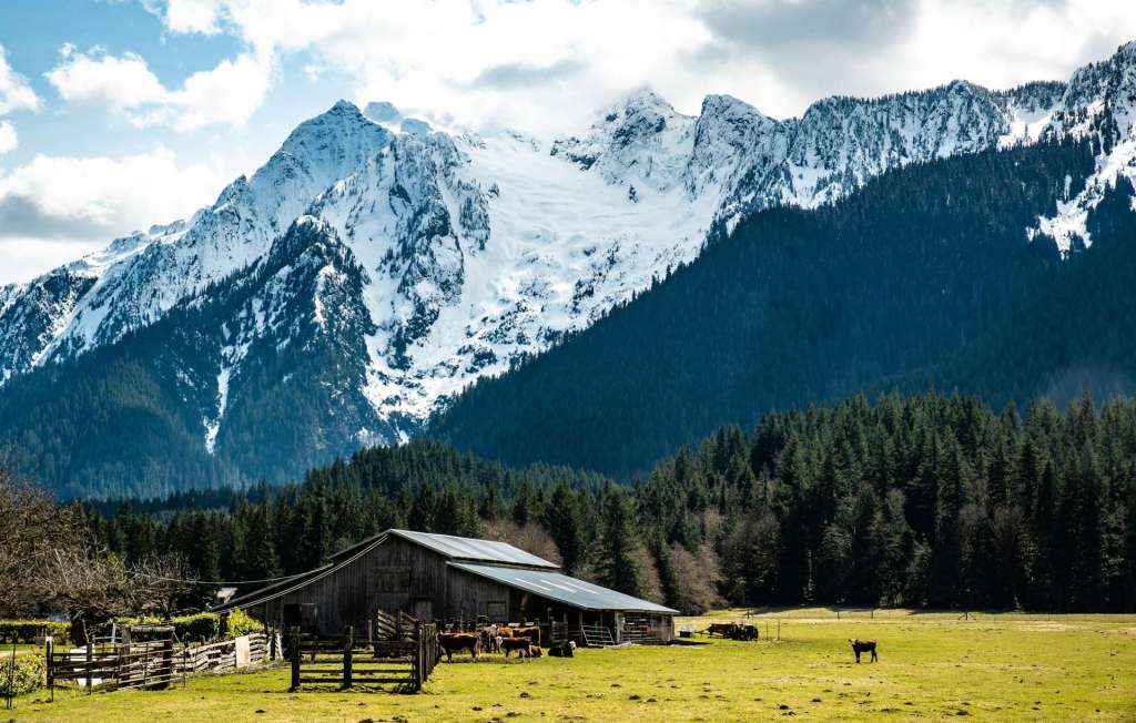
Whitehorse Mountain is still dusted by snow in the middle of spring, below. The So-Bali-Alhi glacier slides slowly towards the flat bottom land of the Stillaguamish River valley, home to small farms like this dairy farm near State Route 530, west of Darrington, Washington.
This description of the final leg of SR 530 begins at the Darrington Rodeo Grounds, 3.5 miles west of the center of Darrington, travels east to Darrington itself, where we’ll wander around a bit, then head north on SR 530 past the Hampton Lumber Mill and Sauk-Suiattle Reservation to the village of Rockport, on the Skagit River.
Rodeo Grounds
Driving towards the timber town of Darrington, a traveler will see a brightly painted sign on the left that announces the Darrington Rodeo Grounds. A local access dirt road runs between the front of the Rodeo Grounds and SR 530. A black, steel silhouette of a cowboy leans against the gatepost to the entrance of the Rodeo Grounds. The cowboy holds a hand-painted sign for cowboy church that met Wednesday evenings before the pandemic struck. Riding arenas, corrals, and bleachers are down the driveway. To the right of the gate, a sign announces that the Darrington Trapshooters shoot at the Rodeo Grounds.


The Darrington Rodeo Grounds were closed for most of 2020, and the Darrington Timberbowl Rodeo in late June was canceled due to the pandemic shut down. The web page of the Rodeo Grounds states, “We want to support our community and keep everyone safe in this difficult time,” adding that the decision to cancel the 2020 Timberbowl Rodeo was a very difficult decision. The Timberbowl and other events like trapshooting and camping are planned for 2021 if the pandemic doesn’t prevent the events.
Both sides of the highway and behind the bleachers and arena are lined with walls of tall green fir trees that stand beneath snow-capped mountains holding the river valley. Power towers that carry electricity to Darrington and to the lumber mill march along the highway in front of the Rodeo Grounds.
East of the Rodeo Grounds, a large grassy area is space for the Darrington Bluegrass Festival. The 2020 Darrington Bluegrass Festival was canceled by a vote of the Bluegrass and Country Music Makers Association to protect the health and safety of all involved. Fortunately, the website of the Bluegrass Festival states, “We are in the process of determining if we are able to hold the festival for 2021. The 2020 musicians have all voiced support and are all willing to play for 2021. We just need to determine if we can safely hold the festival for you.” If possible, the festival will be held in mid-July. In the winter of ’20-’21, the Bluegrass Festival grounds are an open field behind a sign.


The Darrington Bluegrass Festival claims to the be the “Bluegrass Capitol of the N.W.” The Festival has its roots in the logging industry that is the foundation of Darrington. The first loggers who came to the area were from Norway. the Norwegian loggers were followed by loggers from North Carolina. Descendants of those early Tarheel lumbermen started jamming in the 1950s. Over the years, national acts came to Darrington from time to time. Eventually, the audiences grew large enough that the musicians founded the Bluegrass Festival at the Rodeo Grounds in 1977. The Festival purchased and moved to the land to the east of the Rodeo Grounds in the 1980s. The 2021 schedule is to be determined.
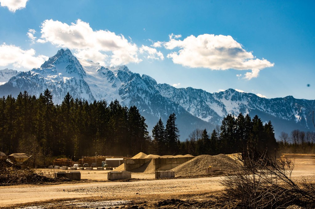
Three and a half miles east of the Rodeo Grounds and Bluegrass Music Park, the traveler on SR 530 will enter the town of Darrington. The highway passes a hardware store and lumber yard backdropped by dark green firs and snow dusted mountains, next to the road to the Darrington Municipal Airport.


Darrington
Darrington is a town of under 1,500 people, a town built on logging in the dense, old forests of the North Cascades. Darrington was incorporated in 1945, although the first non-indigenous settlers came to the area in the 1880s. The first settlement was near the Sauk-Suiattle traditional lands on the banks of the Sauk River.
Prospectors were among the first to settle in the area, looking for gold and other minerals in the mountains. They were soon followed by immigrants from Norway and other Scandinavian countries and from North Carolina and rural areas in the Appalachians who came to work in the logging industry. Logging and timber milling became the principal industries in Darrington and continue to support the town and people who live in the nearby area.
Darrington continued to be an isolated place until the end of the 1890s, freight coming east by canoe on the North Fork of the Stillaguamish or south on the Sauk River from the Skagit River or by pack horse through the mountain passes. In 1899, miners in the town promised the Seattle & International Railway 75 percent of their ore shipments for the next 15 years in order to support the building of a rail line up the Stillaquamish Valley. Before the work was finished, the Northern Pacific took over the S & I. The railway used a new technology, a rail-laying machine to complete the 28 miles.
The railroad carried milled lumber and logs, and passengers on weekly trips, from Darrington to Arlington between1902 and 1990, when it ended service due to repeated flooding of the North Fork of the Stillaguamish. Locally, the railway was known as the Whitehorse Express. The Whitehorse Express was named for Whitehorse Peak, a majestic snow-capped peak amid a range of peaks that are the south wall of the valley, above State Route 530, and not far from Darrington. The mountain, in turn, was named for a horse owned by the first postmaster in Darrington, Fred Olds. The rail bed of the Whitehorse Express, the local name for the Northern Pacific railway, was purchased by Snohomish County and converted to the Whitehorse Trail, a pedestrian and horse trail, in 1995.
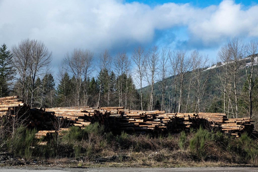
Today, the Hampton Lumber Mill that straddles SR 530 on the north edge of Darrington provides many of the jobs for Darrington. Hampton has facilities in Washington state, Oregon, and British Columbia. The Darrington mill produces 60% Hem-fir, 30% Douglas fir, and 10% other woods. The Darrington mill has an annual production capacity of 290 million board feet.

Darrington is eight blocks or fewer wide, from west to east, and seven or eight blocks long, north to south. Tall, dark green fir trees surround the town, dense forests that were logged to make space for the town. The Sauk Prairie and the slopes of the snow-capped mountains that surround the valley between the North Fork of the Stillaguamish and the Sauk Rivers are covered by trees, as Pete Seeger sang, “covered all over in timber thick as hair on a dog.”
The town has one grocery store, the IGA at the intersection of SR 530 NE and Railroad Avenue, and a convenience store in the gas station at SR 530 NE and Mountain Loop Highway. Seven churches provide religious services in Darrington for a population of not quite 1500 people: two Baptist, one Catholic, one Methodist, one Church of God, one Catholic healing shrine, and one Assembly of God.
Darrington High School and Elementary School are small, reflecting the population of Darrington. The school district staff has been vaccinated for Covid-19, thanks to the efforts of the Sauk-Suiattle Tribe and the Darrington Pharmacy. The high school students are called the Loggers.
The Darrington Library is located on Cascade Street, across the street from the Nels Bruseth Memorial Park, and on the other side of the block from the Police Department. The Library is a branch of the Sno-Isle Library system.


A memorial garden and a memorial park in Darrington are named after Nels Bruseth who was instrumental in the growth of the town. Bruseth worked for the Forest Service from 1916 till his retirement in 1951, beginning as a fire lookout and ending as an assistant to the District Ranger. A painter, photographer, and explorer, his mountain art is available in various places. The Nels Bruseth Memorial Park, near downtown, has a disc golf course.
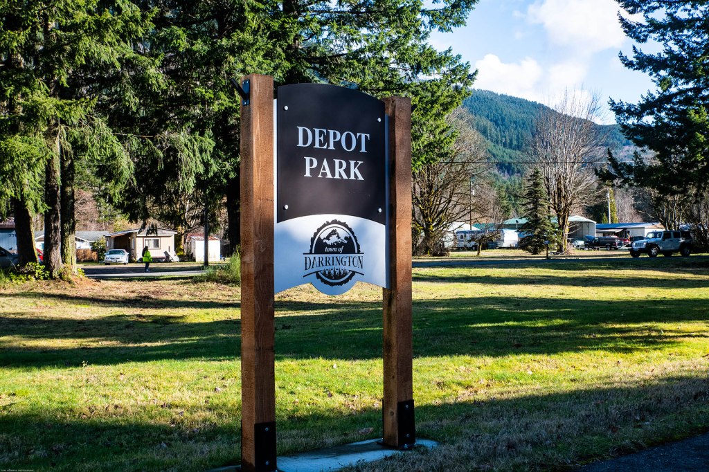
Railroad Avenue follows the tracks of the historic Northern Pacific Railway. Railroad Avenue cuts through town at an angle from the the Whitehorse Trail trailhead on the north side of town, past the IGA, and ends at the Old School Park. The Old School Park, a block square at the intersection of Alvord and the Mountain Loop Highway, includes a skate park, basketball and tennis courts, a pioneer commemorative walk-way, and a playground. If Railroad Avenue continued following the tracks (removed 25 years ago) of the old Northern Pacific, it would pass the site of the NP depot. That location across the street from Old School Park is now Depot Park, a pleasant, grassy triangle occupied by dark green firs and cedars.

State Route 530 continues east across the width of Darrington to a a four-way stop intersection on the east side of town. This is the only stop sign on SR 530 between Arlington and Rockport. A right turn will take a traveler south through high mountain passes, past ice caves and campgrounds, to Granite Falls, then on to Lake Stevens on State Route 9, a great day trip loop. A left turn at the intersection takes the traveler north on SR 530, past the Hampton Lumber Mill, and on to Rockport.

SR 530 to Rockport
SR 530 travels 19 miles from Darrington north to Rockport, through dense, dark green fir and cedar forests, following the Sauk River in the Sauk River Valley. Six miles north of Darrington, SR 530 passes the Sauk-Suiattle Reservation. The tribe operates a smokeshop and small store just off the highway. A casino owned by tribe closed a few years ago. At one time, the tribe ranged from the Salish Sea in the west, to central Oregon in the east, and from the Fraser River in British Columbia to what is now US 2. Tribal membership dwindled in the nineteenth and early twentieth centuries, until by 1924 the tribe numbered only 18 persons. Various sources estimate the tribal membership now at between 200 and 400.
North of the Sauk-Suiattle Reservation, SR 530 crosses the Sauk River on the Sauk River Bridge. The through truss, grate deck bridge was built in 1958.
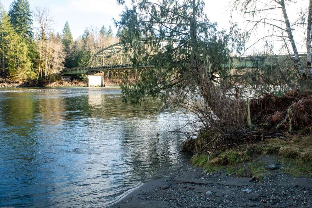

Beyond the Sauk River bridge, SR 530 continues north through fir and cedar forests for 12 miles to the SR 530 bridge over the Skagit River and the small community of Rockport.


Rockport
Rockport sits at the junction of two state highways. SR 20 travels east from US 101 on the Olympic Peninsula, past Rockport, on its way over the North Cascades, and running to the eastern border of Washington state. SR 530 runs east from I-5 to Arlington to Darrington, then north to Rockport.
Rockport rests on the north shore of the Skagit River which flows from the North Cascades down to the Salish Sea. Rockport also sits across the Skagit River from its confluence with the Sauk River that flows up from the south. The crown of Sauk Mountain with slopes covered by tall, green firs, stands high above Rockport to the north.


Driving north on SR 530 from Darrington, a traveler entering Rockport will cross the Skagit River on the SR 530 bridge. If the crown of Sauk Mountain is not wreathed in clouds, as it often is, the mountain will be ahead, robed in tall firs. Immediately past the bridge, there are two roads on the left that connect with SR 530. The first road, Rockport Park Road, leads into Howard Miller Steelhead Park, a Skagit County camping and recreation park.
The second road on the left is Railroad Avenue which sits on a historic railroad track that once connected Rockport with the City of Burlington, 37 miles west, points south (Seattle), north (Bellingham and Vancouver, BC), and west (Anacortes). Railroad Avenue is roughly a block long here, to the intersection with Rockport Park Road, coming up from the left, and Alfred Street, which climbs a slope to SR 20. Railroad Avenue continues past the Rockport Bar & Grill – plus Store. It’s been the Rockport Bar & Grill for years. The “plus Store” was added recently. Once known as something of a biker bar, it now offers breakfast, lunch, and groceries, as well as beer, for the campers across the road in Steelhead Park.


Both the Bar & Grill plus Store and the Post Office face south across Steelhead Park and the Skagit River Valley towards the hills and peaks beyond the river. The Post Office is on the west side of the intersection. An older block and stucco building, the Post Office porch is protected by a somewhat battered steel roof.


Railroad Avenue continues west for two blocks to the end of town. Railroad Avenue curves around and becomes Main Street, returning to Alfred Street. Just up the hill from the Main and Alfred intersection, overlooking the town, Steelhead Park, and the valley, is the old Rockport School. Rockport kids now take buses to Concrete for school, nine miles west on State Route 20. The school building is now home to the Rockport Volunteer Fire Department. When I visited in 2020, brightly painted fire trucks, one red, one yellow, were parked outside of the school/fire department.

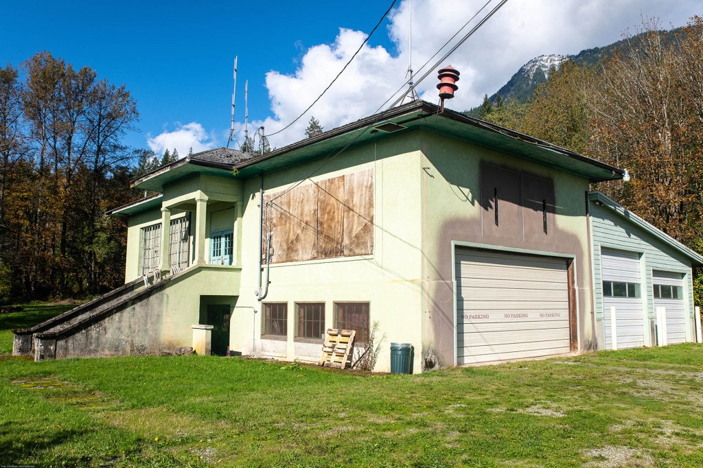
The sign below the Rockport Fire Department sign reads, “In recognition of the volunteer efforts and in memorial of those lost – 3/22/2014” The aging fire trucks parked on the right are still in use. The fire station was formerly the two-room Rockport School. This historic two-room school building was built in Rockport in 1909 or 1910. School children now ride a bus to Concrete, nine miles west on State Route 20. The building and an addition on the back is now home to the Rockport Volunteer Fire Department. A siren to summon the fire fighters is on the roof at the corner. Rockport is squeezed between the Skagit River and SR 20. About 50 people lived in Rockport in 2018.
Railroad Avenue was once the eastern end of the Seattle and Northern Railway line that ran from Anacortes, on Fidalgo Island, through Woolley (now part of Sedro-Woolley, and up the Skagit River Valley, through Concrete, to Rockport. The Seattle and Northern eventually merged with the Great Northern Railway. The plan had been to push over the North Cascades and connect with the Great Northern lines that were building westward from Chicago, eventually making Anacortes a major port. The S & N (and, later, the GN) ended at Rockport, partly due to lack of money, and partly due to the steep, nearly impassable slopes near Newhalem at the eastern end of the Skagit River Valley, 24 miles east. A separate line, the Baker River Railway, was built on a different gauge from Newhalem to Rockport to carry logs down from the North Cascades, and to carry workers and equipment up the mountains to construct Gorge, Diablo, and Ross Dams for Seattle City Light. Howard Miller Steelhead Park, between Rockport and the Skagit River, was once the turnaround and service yard for the Seattle and Northern.
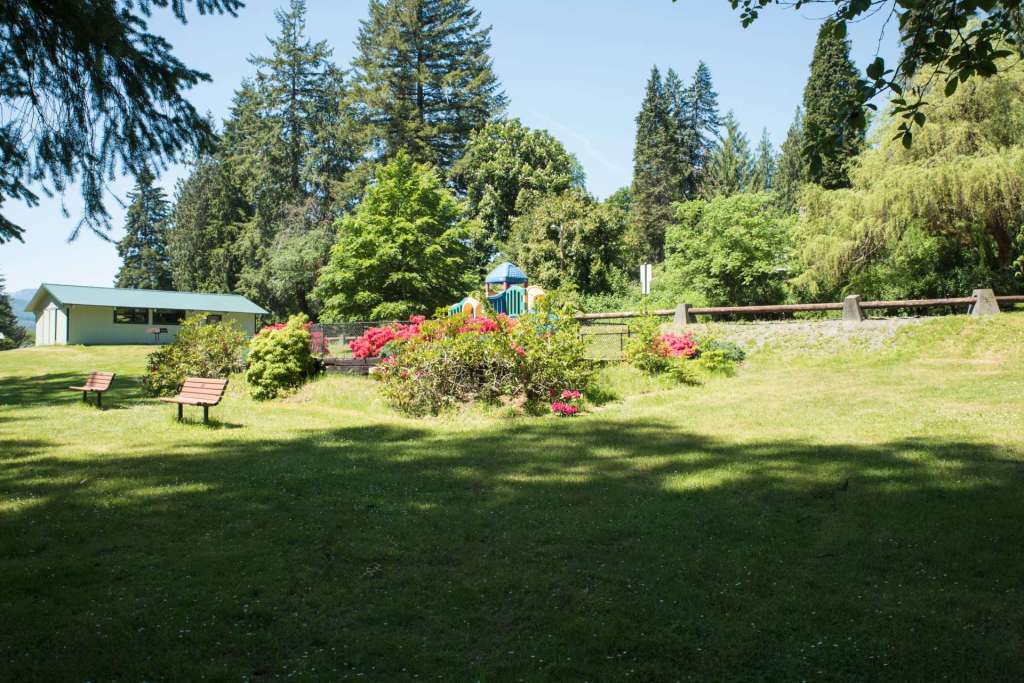
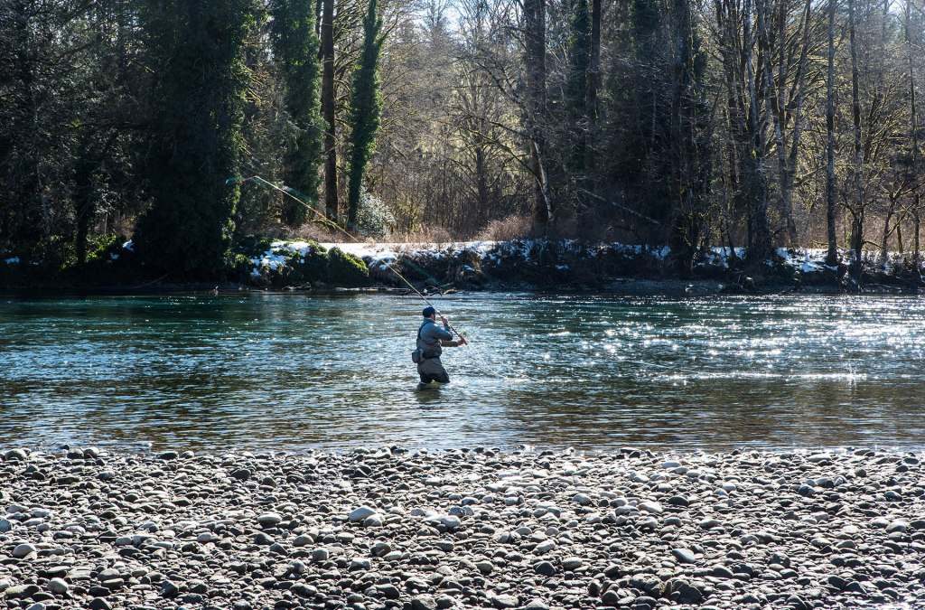
Howard Miller was a Skagit County commissioner for many years and was instrumental in the development of the park that bears his name. Steelhead Park is about 103 acres, spread along the river, and includes boat ramps, RV spaces with utility hookups, river access for fishing and viewing bald eagles in January, hiking trails, tent camping spaces, and large grassy areas for recreation and relaxation. It’s a lovely place to spend a day or a longer vacation.

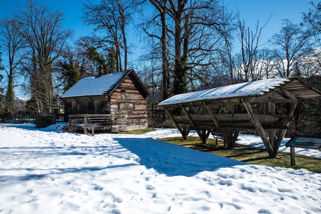
Tom Porter built this cedar log cabin on the bank of the Skagit River in the late 19th century in what is now Rockport, 37 miles east of Burlington in the foothills of the North Cascades. Porter and his wife and children lived here for many years. A canoe used by Porter, hand carved from a single cedar log is supported by a shelter on the right. The descendant of a rose bush brought from the east by Mrs. Porter still stands next to the cabin in front of the trellis on the corner of the cabin. Salmon fishing in the Skagit River is also a popular pastime.
For people who like quiet, rural living in the midst of tall green fir trees next to a wide river with good salmon fishing, Rockport must be ideal.
State Route 530
Washington State Route 530 is a two-lane highway that begins at Interstate 5 in Snohomish County, passes east through Arlington, then parallels the North Fork of the Stillaguamish River, past the Oso Slide Memorial, and between the snow-capped, glacier-laden mountains, to the timber town of Darrington. In Darrington, the road turns north, and travels along the Sauk River to Rockport on the Skagit River, in Skagit County. The road is only 47 miles long, a short distance as highways go. Nevertheless, it passes through beautiful country, among farms and forests, and deep into the history of northwest Washington.
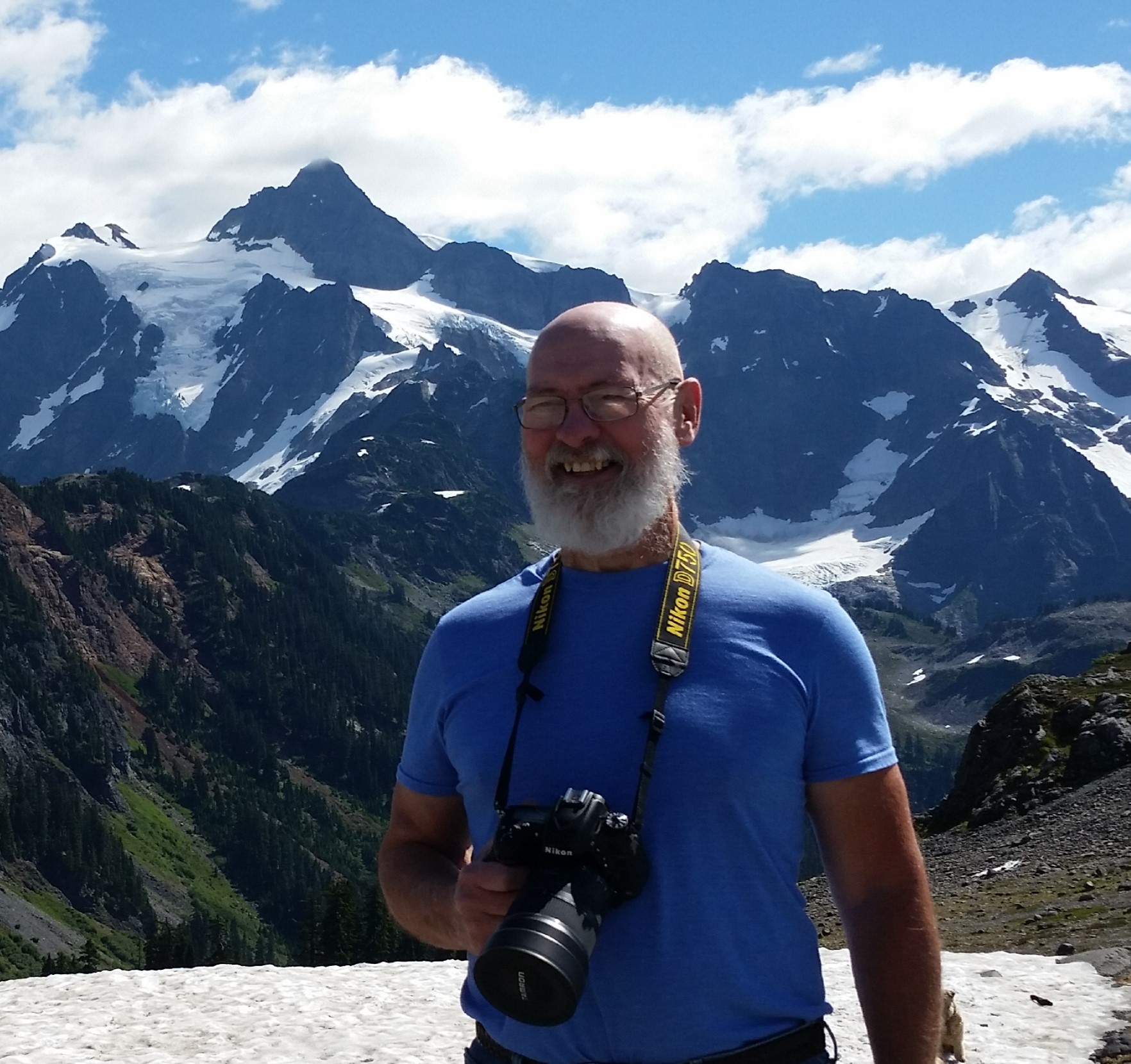
The images and text in this post, and in all the posts of this series, are copyrighted by me, dba Tom Cochran Vagabond Photography. The images are in my Washington State Route 530 collection and are available for sale as archival paper and canvas wall hangings and household items like cups, towels, and shower curtains. Please visit when you can.
Categories: State Route 530, Washington State Journeys